
Historic Delfshaven
Resilience for the neighborhood with history

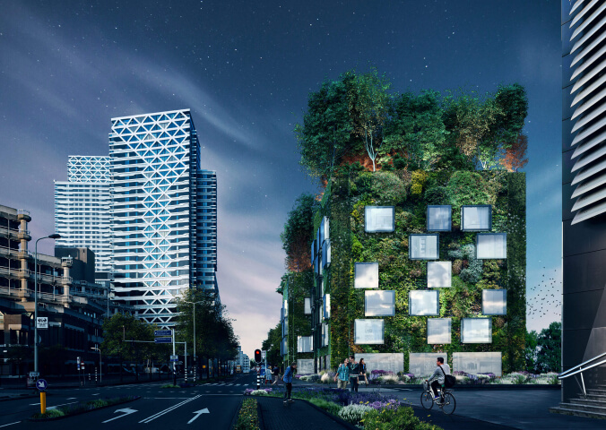
Part of the old city of Rotterdam, Delfshaven is a place with rich history. It is known as a birthplace of the illustrious admiral Piet Hein and the place of the Pilgrim Fathers’ departure for America. Delfshaven is also one of the few parts of the city that survived the 1940 bombing. Various developments are underway around the area: the Vierhaven strip with the roof park; the redevelopment of the Schiehaven; and several other projects. The diversity of developments and initiatives require an unambiguous strategy for public space.
 Strategic vision plan Historic Delfshaven
Currently the design of many places does not support the existing uses or satisfy aesthetic objectives. Development pressures threaten Delfshaven historic position in the city. In response to these challenges a vision for the future has been developed that connects Delfshaven's historic identity with the new significance of the area in the city. The layout of the public space functions as a guiding and structuring mechanism. Hidden historical and cultural elements are articulated and better connections are made between them to strengthen the identity of the area and to bring structure and cohesion to the various individual projects.
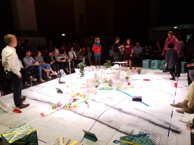
Felixx’ vision for public space, intends to 1) make the historical and cultural elements visible, spatially and aesthetically articulated (again), 2) structure and connect individual developments, 3) strengthen the relationship with the city and the surrounding neighborhoods and 4) improve the general quality of the outdoor space in the residential neighborhoods. The vision emerged through an interactive process of direct engagement with the stakeholders. The design principles are based on the input from users and local residents. The proposals have been tested and refined in consultation with the team of municipal experts.
'LIVING LINES'
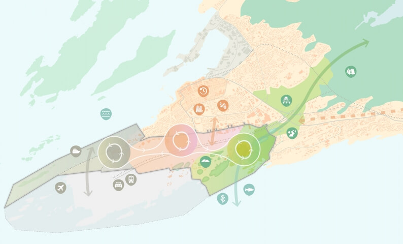
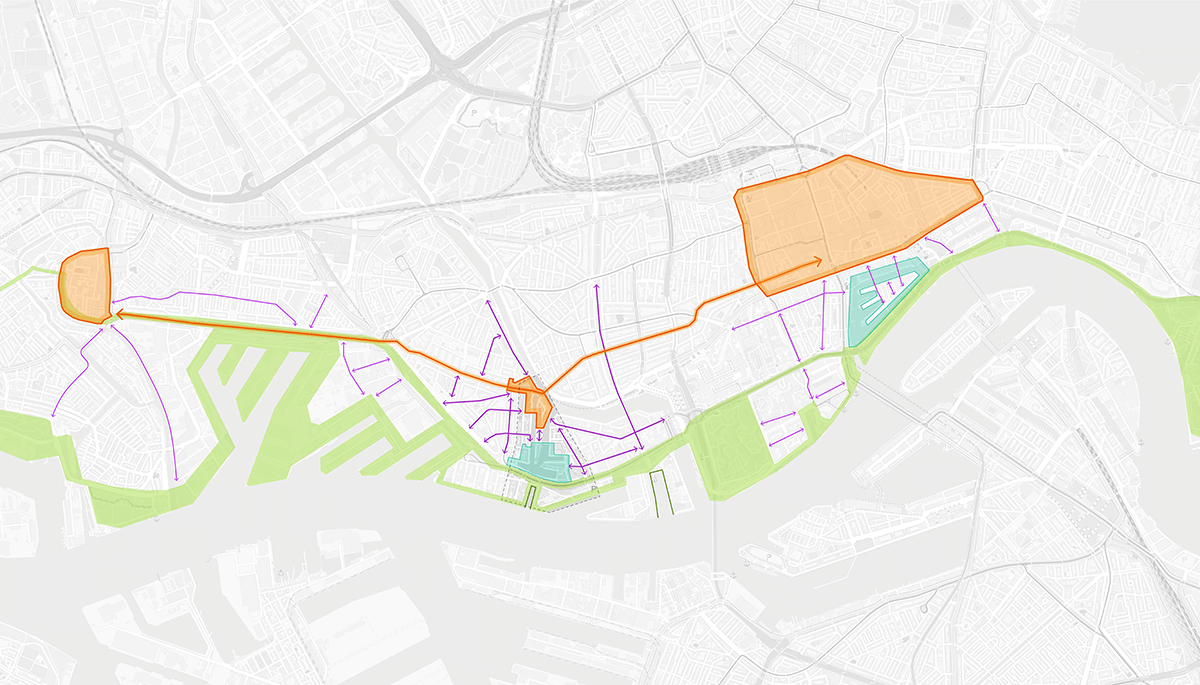
In order to understand the tension that exists in historic Delfshaven, we have analyzed the area based on Living lines. After all, a neighborhood or district does not stand alone, but is connected to its surroundings and the city. A living line shows thematically the role the area plays within the larger urban fabric.
As a result, you can see the spatial impact of a specific theme in an area on the one hand. On the other hand, the role that the area plays for that theme within the city and wider surroundings becomes visible. Different scale levels are thereby thematically linked.

1) the Green and Sustainable city 2) the Programmatic city

3) the Cultural-historical city and 4) the Accessible city
By changing the meaning of a particular living line in Historical Delfshaven, the position of the area in the city also changes: are we strengthening Delfshaven as a residential area or as a tourist attraction? In addition, certain themes can actually reinforce or hinder each other: more parking facilities mean less green space, but car-free streets offer both opportunities for terraces at catering establishments and play streets at homes.
slider
Vision plan larger scale: 1) the Programmatic city 2) the Green and Sustainable city 3) the Cultural-historical city and 4) the Accessible city
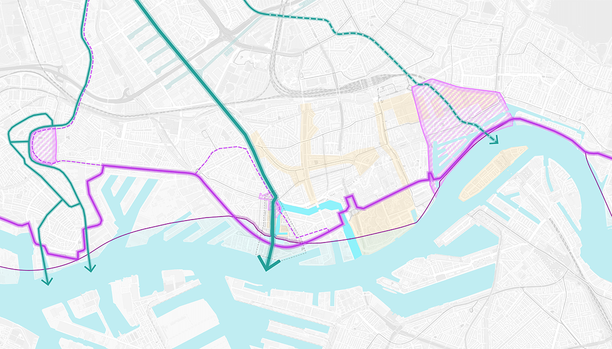
STRATEGIC FRAMEWORK HistoriC Delfshaven

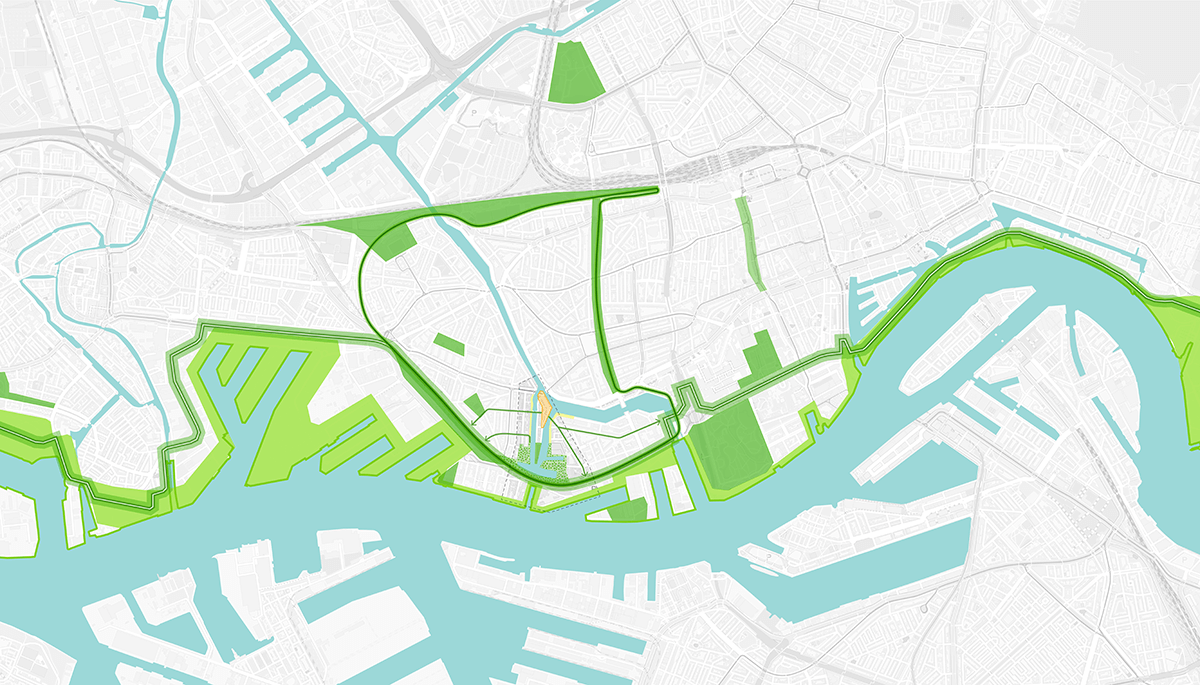
Four spatial structures of the strategic framework
The vision for Historisch Delfshaven is set up as a strategic framework, and consists of four spatial structures:
- Delfshavenplein
- Harbor quay
- Middenkous Park
- Streets and alleys
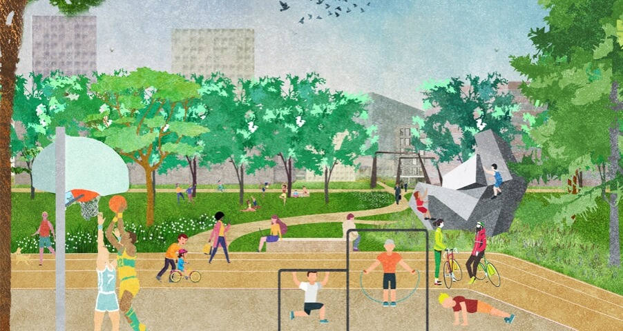
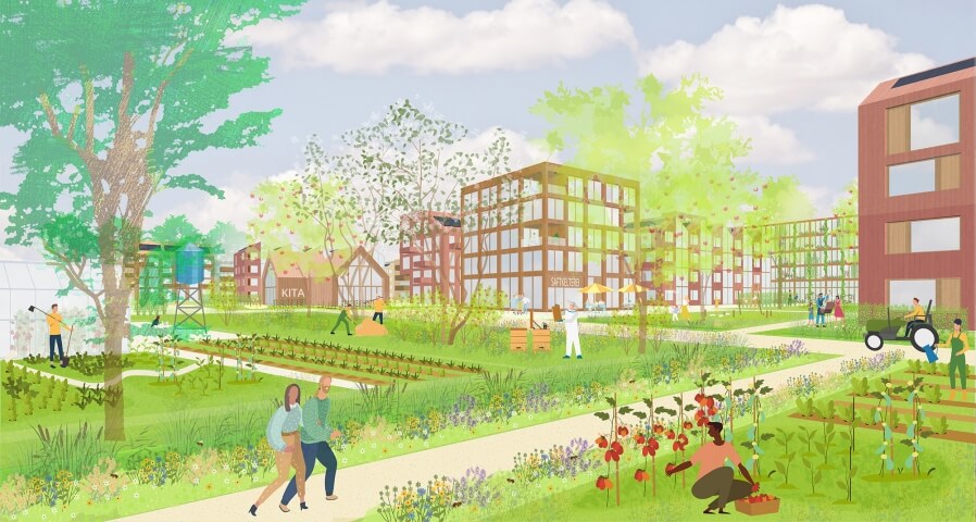
Each structure individually contributes to the addition of new living space and an improvement of the spatial quality of the public space in Historic Delfshaven. The structures can be implemented (partly) separately from each other and in phases. However, combining them ensures cross-pollination. This makes the framework more robust and durable.
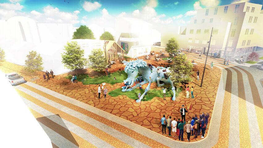
Example locations
For the three locations within the plan area, a spatial translation of the vision has been made on the basis of public space sketch designs. This provides a picture of the development opportunities for these locations. The three elaborations provide an insight into the opportunities and the meaning these places have for Delfshaven.

Master plan details of three example locations 1) Schiedamseweg, 2) Piet Heynsplein & 3) Middenkous
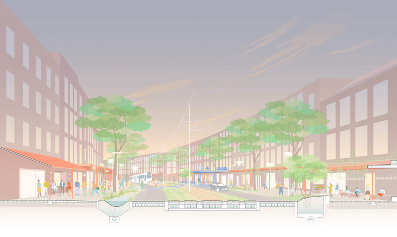
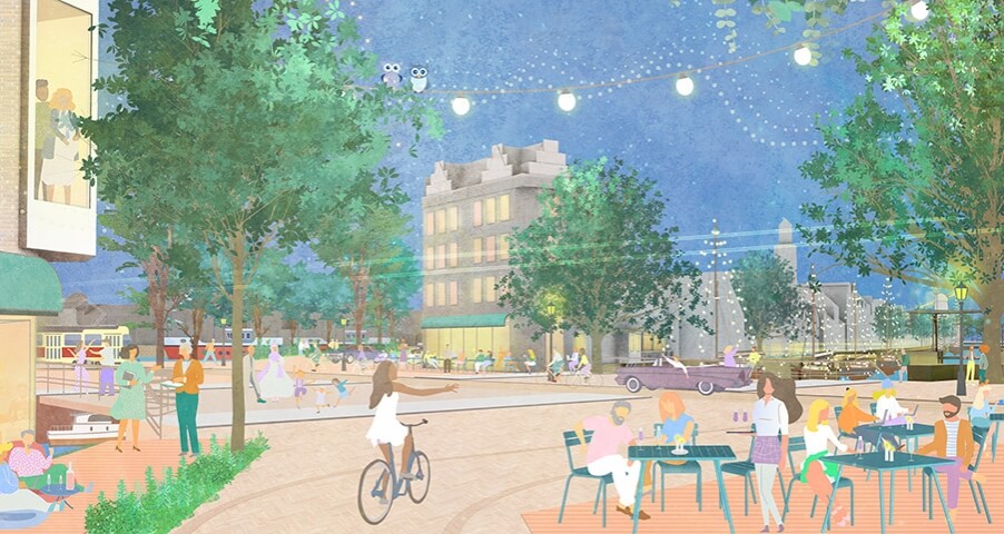
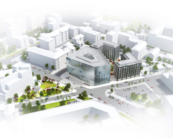
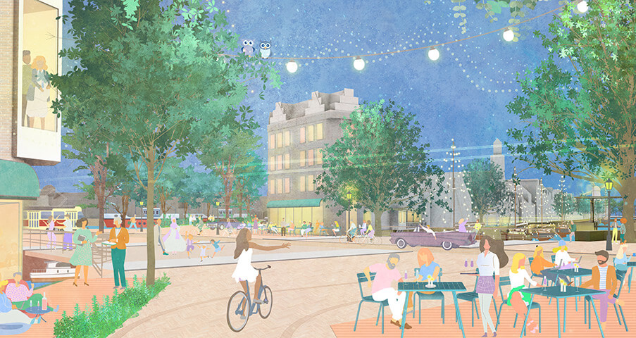
Schiedamseweg
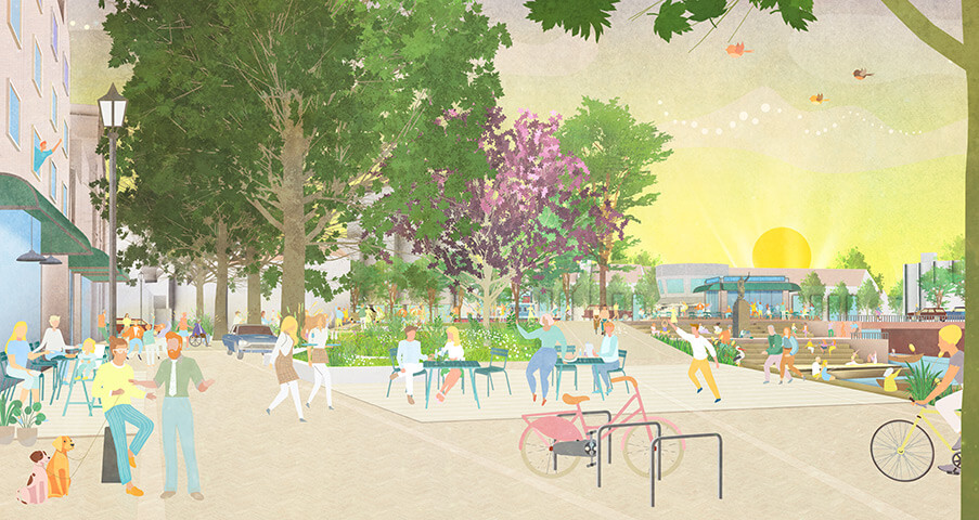
Historic Delfshaven will regain its direct waterway connection with Delft. The current infrastructural node will become an attractive reception space between the two bridges. A terrace with a mooring place will make the experience of water more pleasant and accessible, and offer new opportunities for outdoor dining. The materialization enhances the spatial experience of the square by denying the straightforwardness of the various traffic flows. Together, these interventions strengthen the spatial marking of the central island.
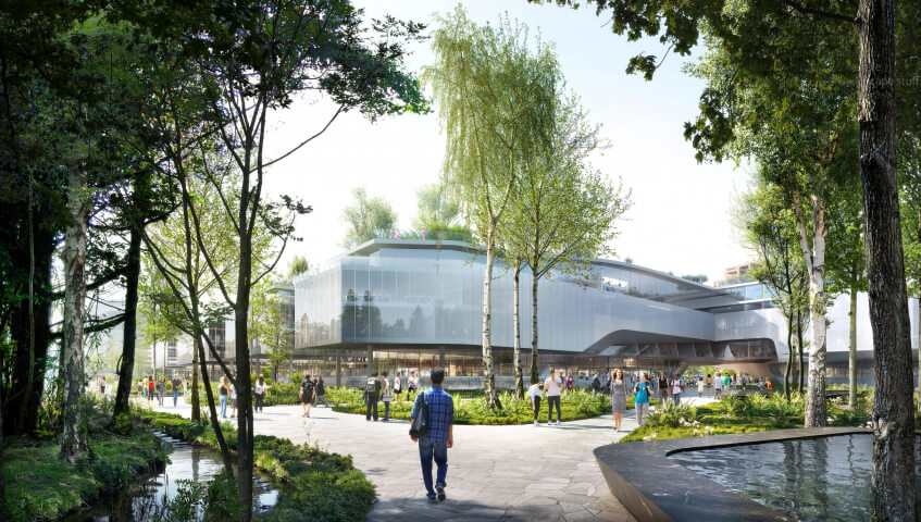
Piet Heynsplein
By redesigning and enlarging the contours of Piet Heynsplein, the square will be given a new boundary. The barrier effect and the difference in height of the dike body and the existing staircase will be replaced by a dike slope with various terraces. This will connect the Piet Heynsplein to the Havenkade and give it an address on the water.
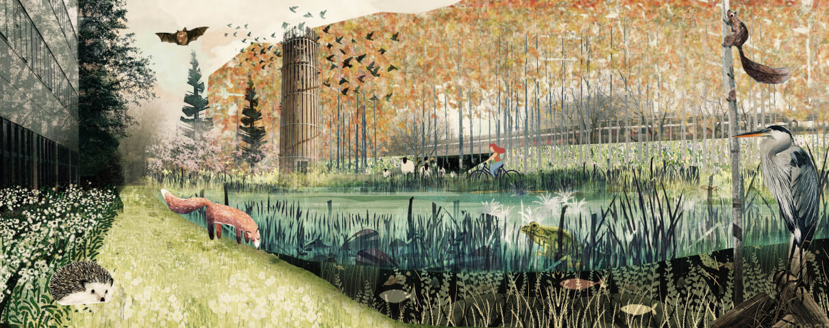
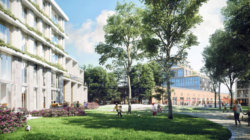
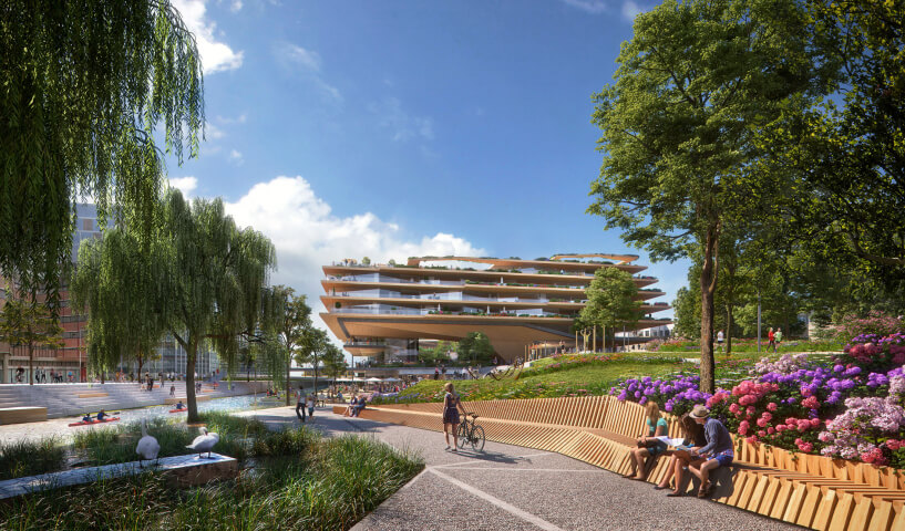
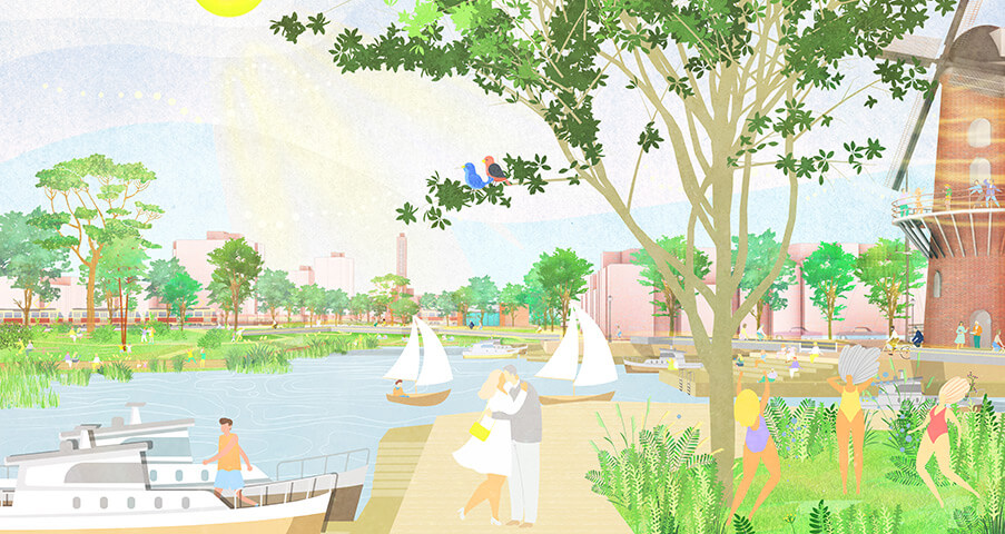
Middenkous
The sketch design for the Middenkous (the harbor parallel to the Westzeedijk) emphasizes the greening of the banks on the south side of the Middenkous and making the central island and windmill the Distilleerketel accessible to slow traffic on the north side. New walking paths and sloping embankments on both sides of the Westzeedijk connect the Middenkous with the Kroon location, Schiemond and the roof park. With the redevelopment of the dyke slopes, the characteristic three-part character of the dyke will be restored, reconnecting the inner dike, the outer dike and the area on top of the dyke to their immediate surroundings.

Year
2020
Location
Rotterdam, delfshaven
Type
Research, Masterplan, Infrastructure, Landscape, Public Space
Client
L.M. Groen Gebiedsaccountmanager, Stadsontwikkeling, Gemeente Rotterdam
Size
49 ha
Publications
'A New Plan for Underexposed Delfshaven' - NRC newspaper, 3 Dec. 2020
Team & partners
Michiel Van Driessche
Deborah Lambert
Marnix Vink
John de Groot
Klaudio Ruci
Anne van Loenen