Smakkelaarsveld Utrecht
A healthy place to live, work, interact and enjoy
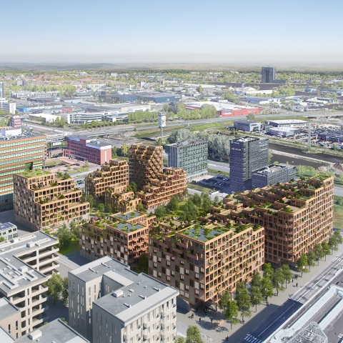
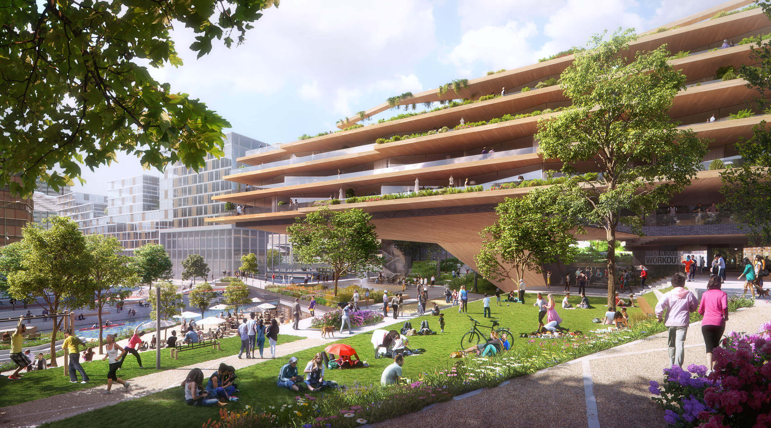
Smakkelaarsveld is located in the center of Utrecht. It is an important open space in the vibrant station district. The area will be redeveloped into a park with a new residential building. Both developments are merged, to generate a variety of conditions. It becomes a vibrant and generous place that embraces the complexity of a park in the modern city. It is a flexible, multifunctional area that can accommodate the future challenges of Utrecht. The layered design is set up as a microstructure of spaces and places, where programs are stacked for a multitude of functions and uses.

Smakkelaarsveld has always been an important point of connection in the development of the city of Utrecht. Since the 17th century it was an inland port on the Leidse Vaart. This harbor was filled in around 1970 and made way for a busy traffic junction. Smakkelaarsveld was redesigned as a peaceful park in 1980, which was later repressed by a gigantic bicycle parking lot. Now it has been a construction site for years. Where in the past the function changed, the layout of the area did too. With this, the history of the Smakkelaarsveld can be seen as a series of non-flexible monofunctional areas. Today various functions are projected on the site, requiring Smakkelaarsveld to be turned into a multifunctional realm.

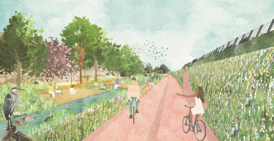
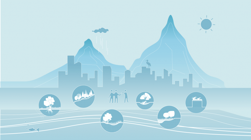
The new Smakkelaarsveld reveals the covered Leidse Rijn, realizing the final piece of the canal system to connect the city center to the wider surroundings. It has to be realized on top of a very intensive infrastructure hub, with a bus and tram line that borders and divides the plot. Both park and building are covering this infrastructural net, to turn Smakkelaarsveld into the last missing green stronghold of the restored city canal. This creates a new green entrance to the station area, making it a logical part of the slow traffic routes that make the area accessible for pedestrians and cyclists.

Moreover Smakkelaarsveld is part of the new city corridor, the cultural axis that connects the historical center of Utrecht with the new center of Leidse Rijn. Therefore, building and park melt together in four distinct urban rooms: the animated Smakkelaarskade, the romantic Smakkelaarspark, the bustling Town Square and the tranquil City Garden. Within the rooms, different scenarios have been created, which offer maximum possibilities for the diverse needs of the various users: passing commuters, lunch visitors and new and old residents. These scenarios are designed in such a way that they give rise to various and diverse use, both collectively and individually, and both planned and spontaneous.
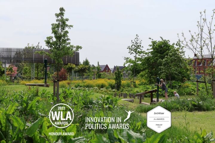
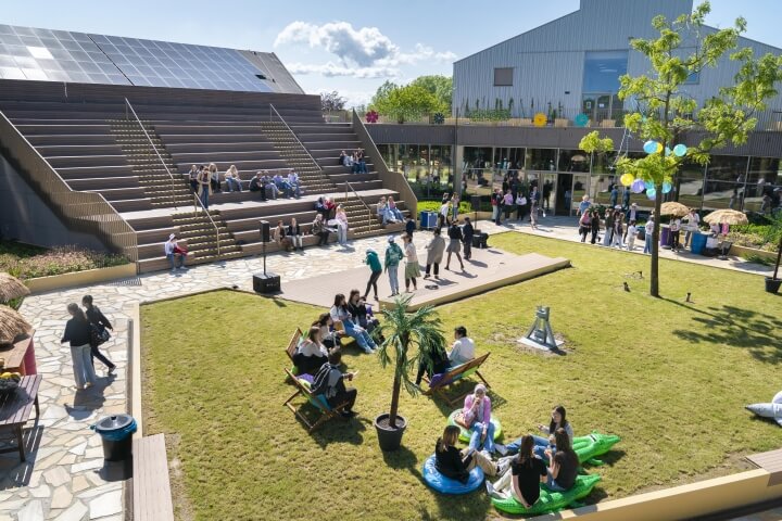
Smakkelaarspark


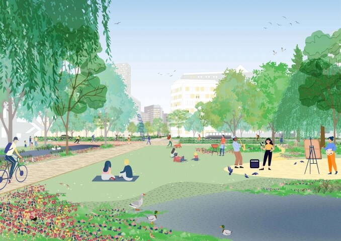
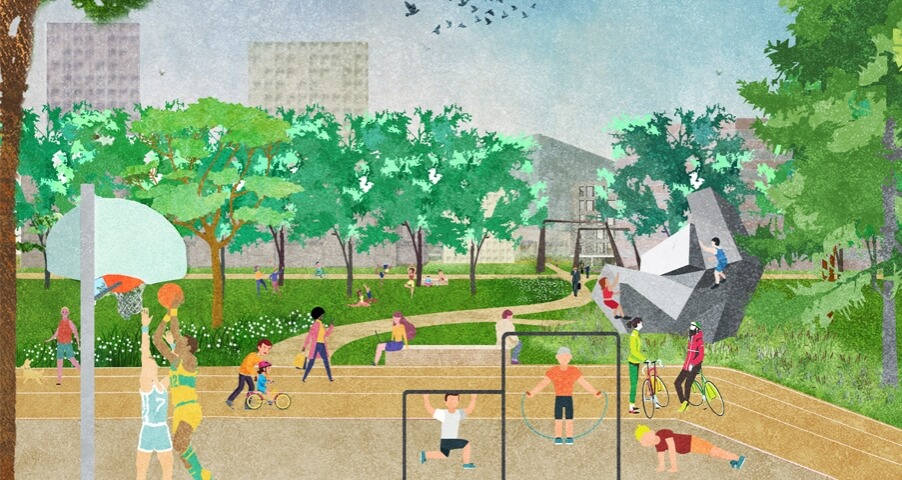
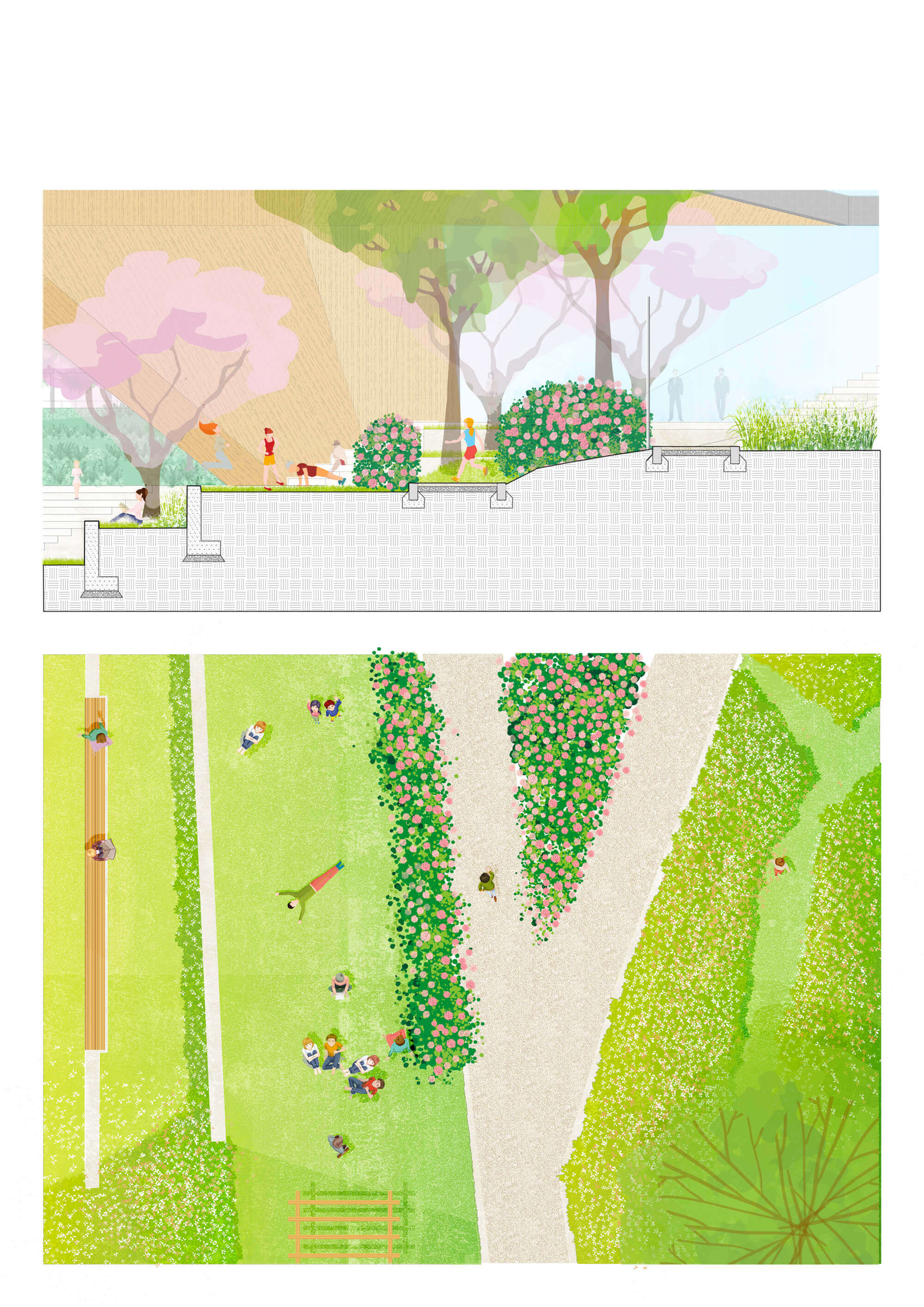
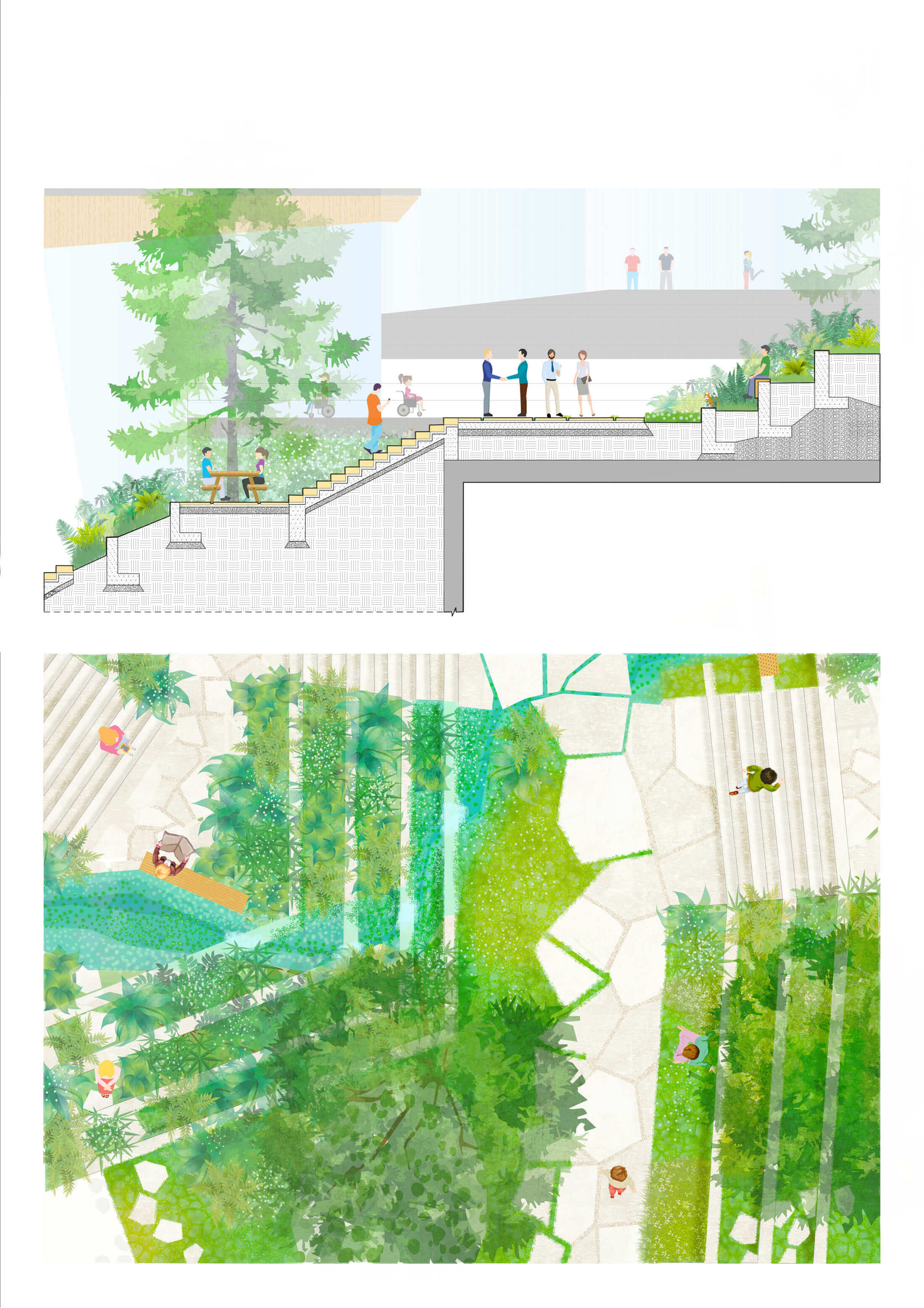
The park offers a generous green space to the city, sloping up from the waterfront to a high green back to cover the public transport lanes behind it. The topography is divided into various flat and gently sloping terraces. The main path runs along the water and leads you to the new Café, a second walking path runs into the park. The edges of the park offer quiet spaces, planted with high grass and wild flowers. Hammocks are set up in a few sheltered areas. The central part offers space for intensive use: the amphitheater with turrets, the stepped sunbathing lawn, sunny seating and picnic areas and sports equipment along the fitness route. Indigenous trees provide open and enclosed zones, while evergreen and flowering Rhododendron bushes steer the whole.
Smakkelaarskade


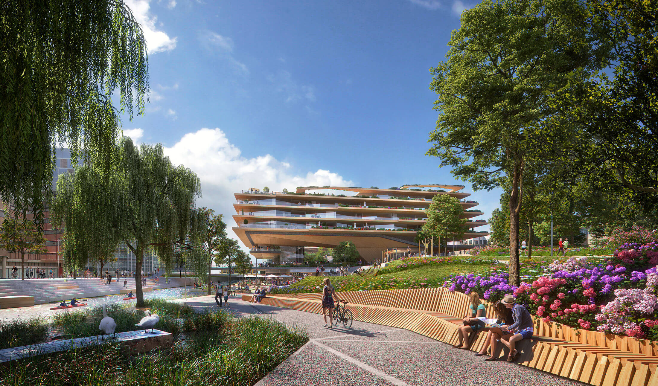
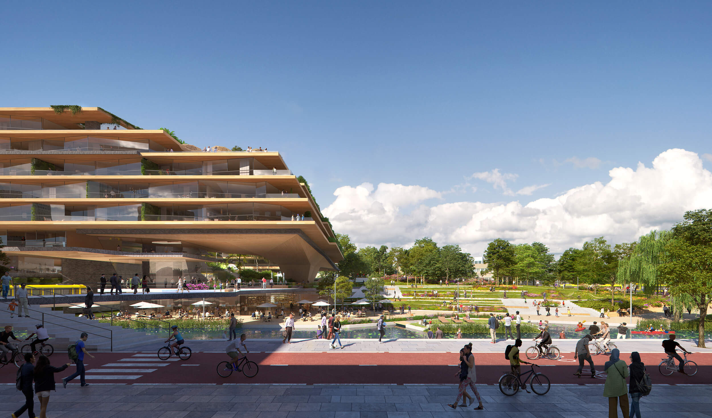
The waterside is very diverse, offering both space for intensive use and much needed urban ecology. Two weeping willows, hanging down over the water, create a magical atmosphere when entering the park. They accompany you along the waving reed at the Leidse Rijn. The soft green bank offers protection to waterfowl and amphibians and illustrates the ecological ambitions of this new sustainable part of the city. The quay starts where the reed stops, with mooring places for boats. In front of the Café, the quay is turned into a square and the water edge of the new Leidse Rijn is animated with spacious green steps. A small island in the water invites to paddle, but also offers the possibility for a spontaneous or organized summer concert.
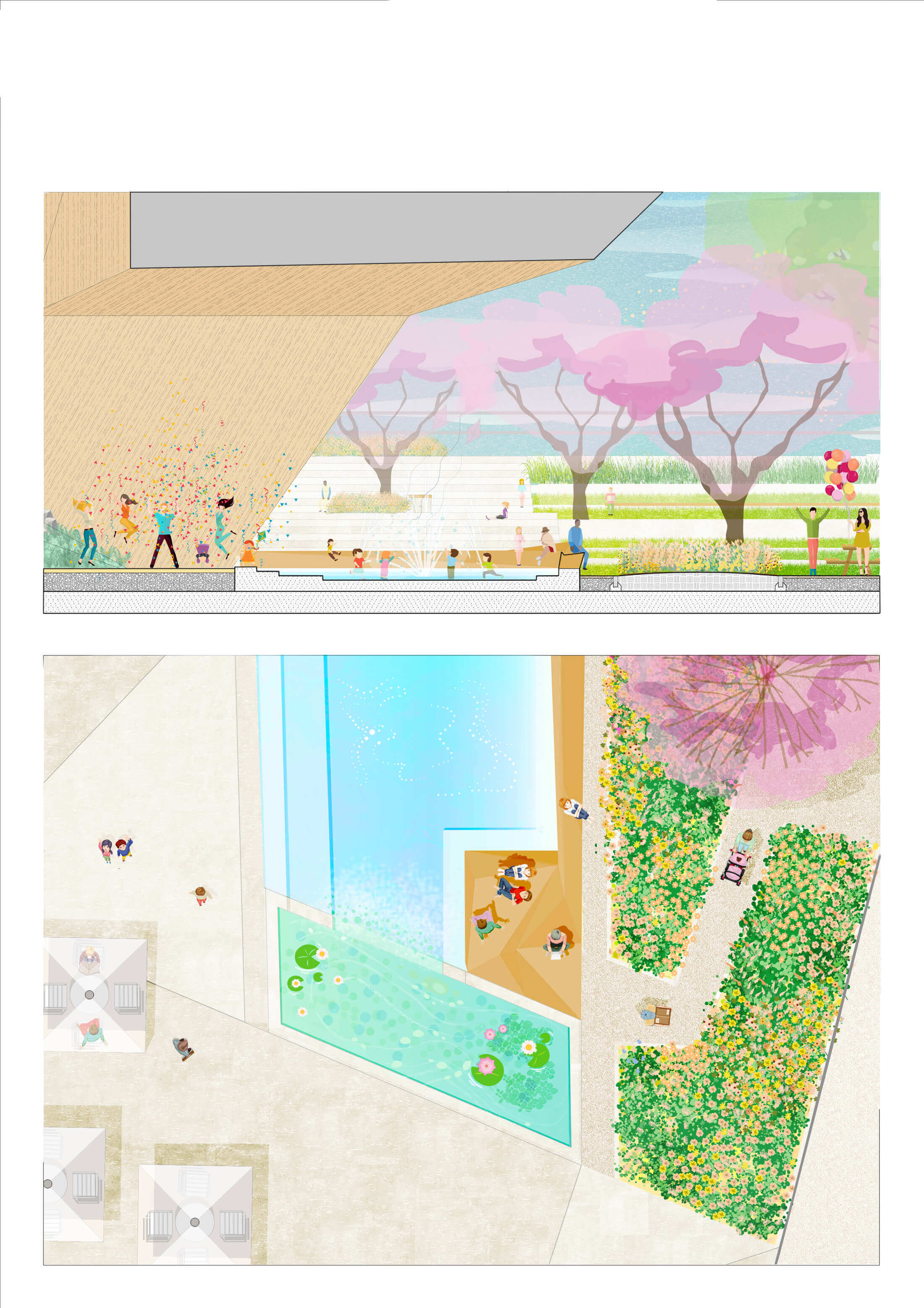
Town Square


On top of the café, we find a monumental city stage with a sculptural wooden roof. The generous opening of the building offers shelter and a scenic setting to overlook the historical city. The plaza is decorated with a water element, spacious benches, flowering plant borders and room for terraces. This square becomes the turntable of all routes within and through the new park. It is a dynamic place, with a bar and fitness club in the plinth of the building that activate the square 24/7.
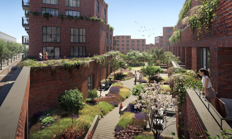
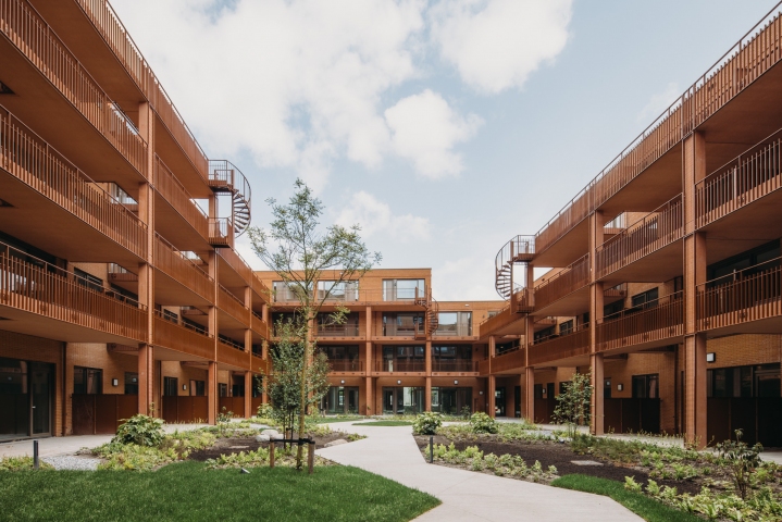
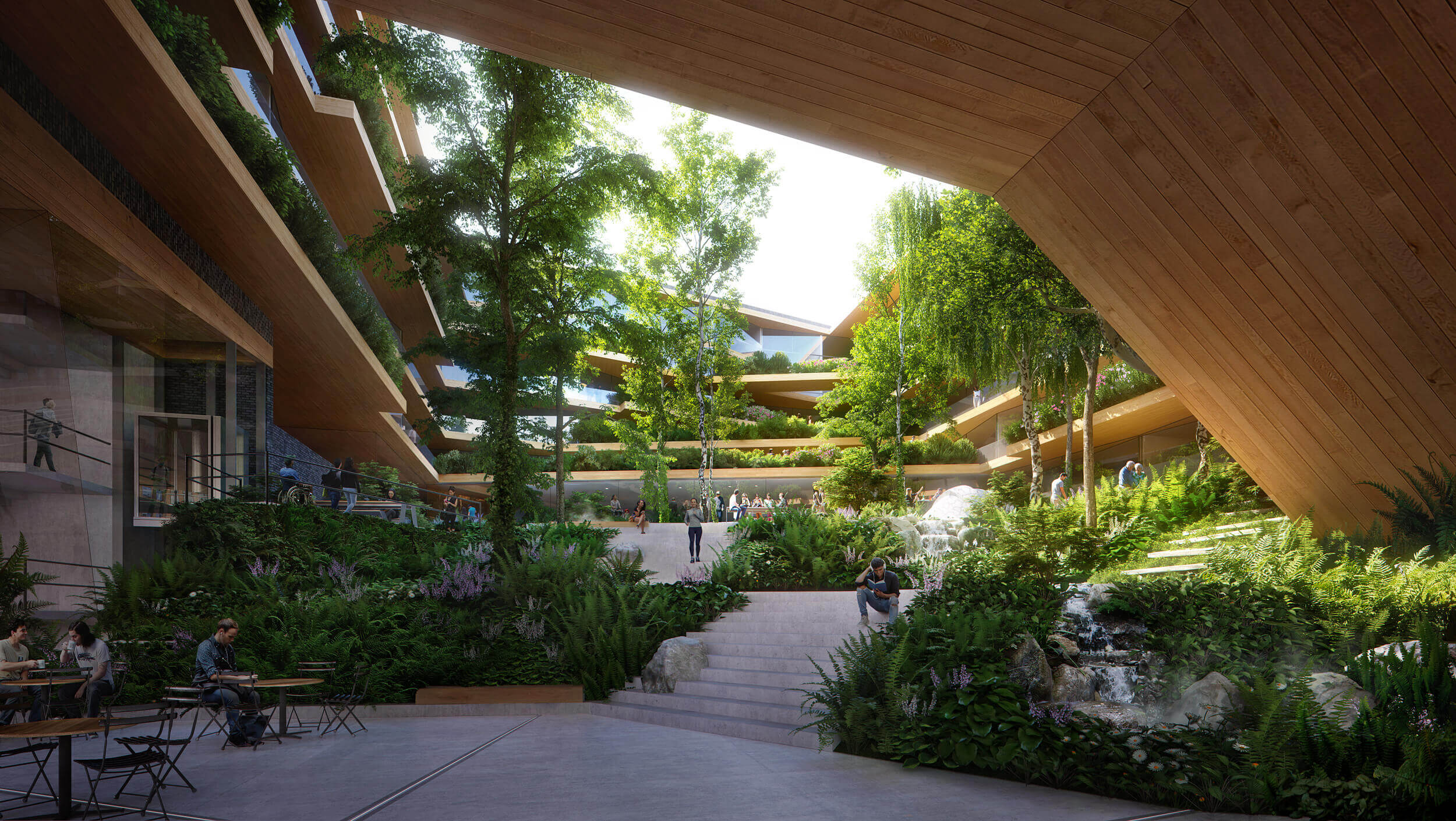
The Quiet Courtyard


The literal Overture of the building invites visitors to the last spatial room, which is located in the inside-carré of the new residential building. The underlying public transport tunnel is covered with a thick green carpet. The park interweaves seamlessly with the building in order to offer a protective and embracing gesture opposite the busy station environment. This room is designed as a green forest. Several small spots are located between the green: wooden benches, picnic tables and a fire pit. A babbling brook, rocks, and the green overgrown paths and stairs guide residents and visitors through an oasis of peace to their destination.

Year
2018
Location
Utrecht, The Netherlands
Type
Landscape, Public Space
Client
Municipality of Utrecht
ABC Nova
Team & partners
Michiel Van Driessche
Marnix Vink
Deborah Lambert
Ilva Mishtaku
Mariya Protsyk
Zofia Krzykawska
Klaudio Ruci
Fanny Genti
UNStudio
Metabolic
Zonneveld Ingenieurs
Movares
DGMR
Basalt Bouwadvies
Spark
Renders by Plomp