


Resilient Riverscape Berat
Seasonal Isles
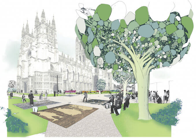
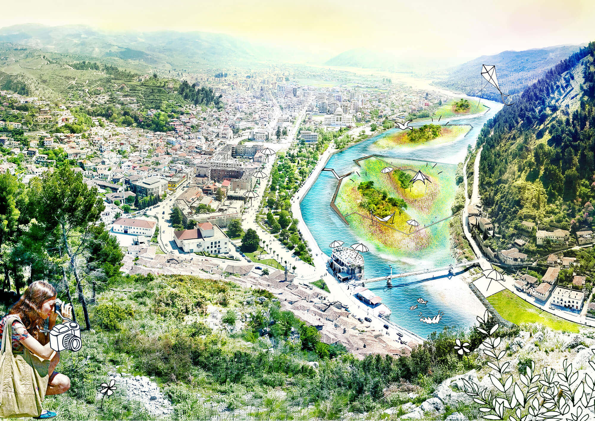
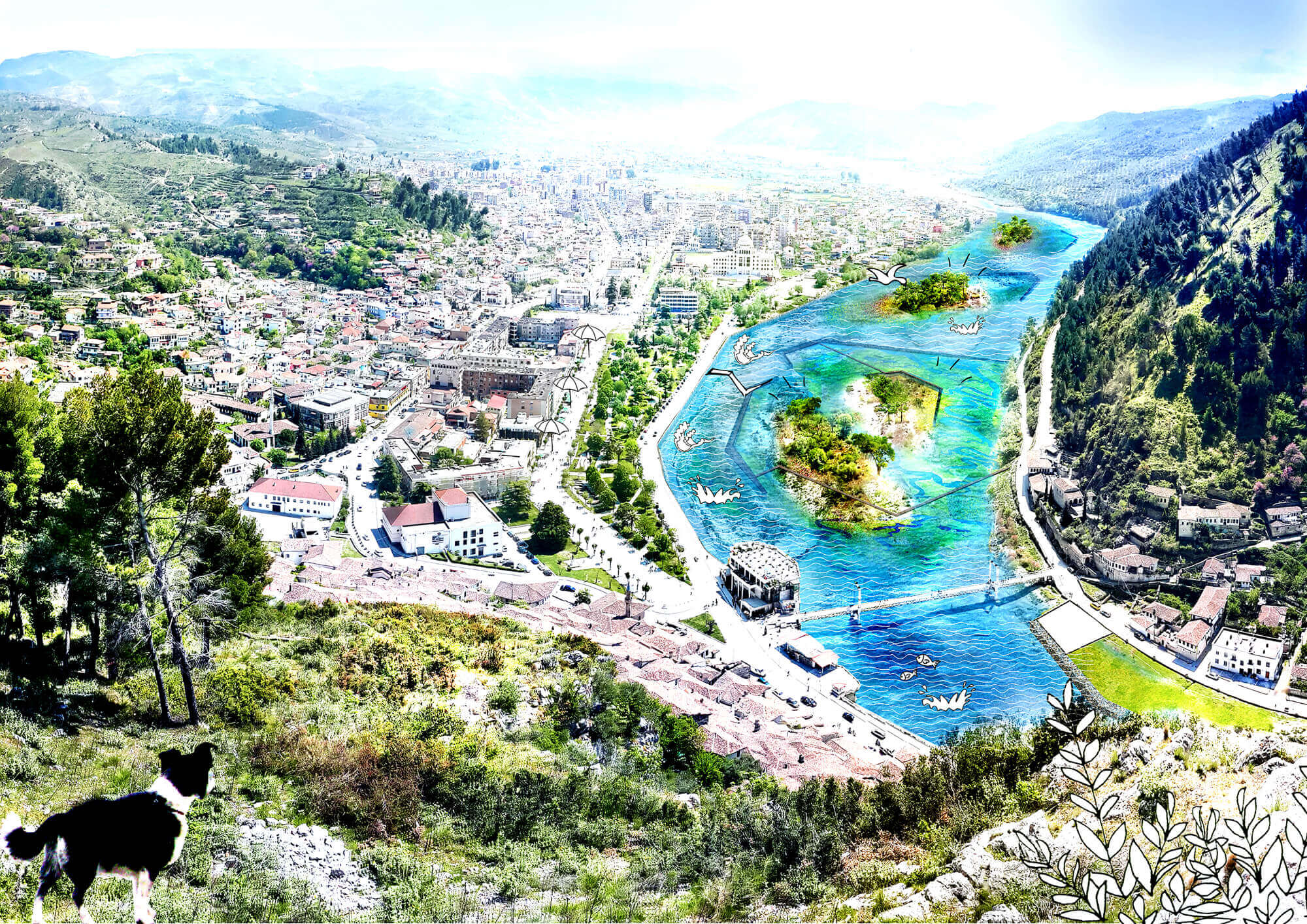
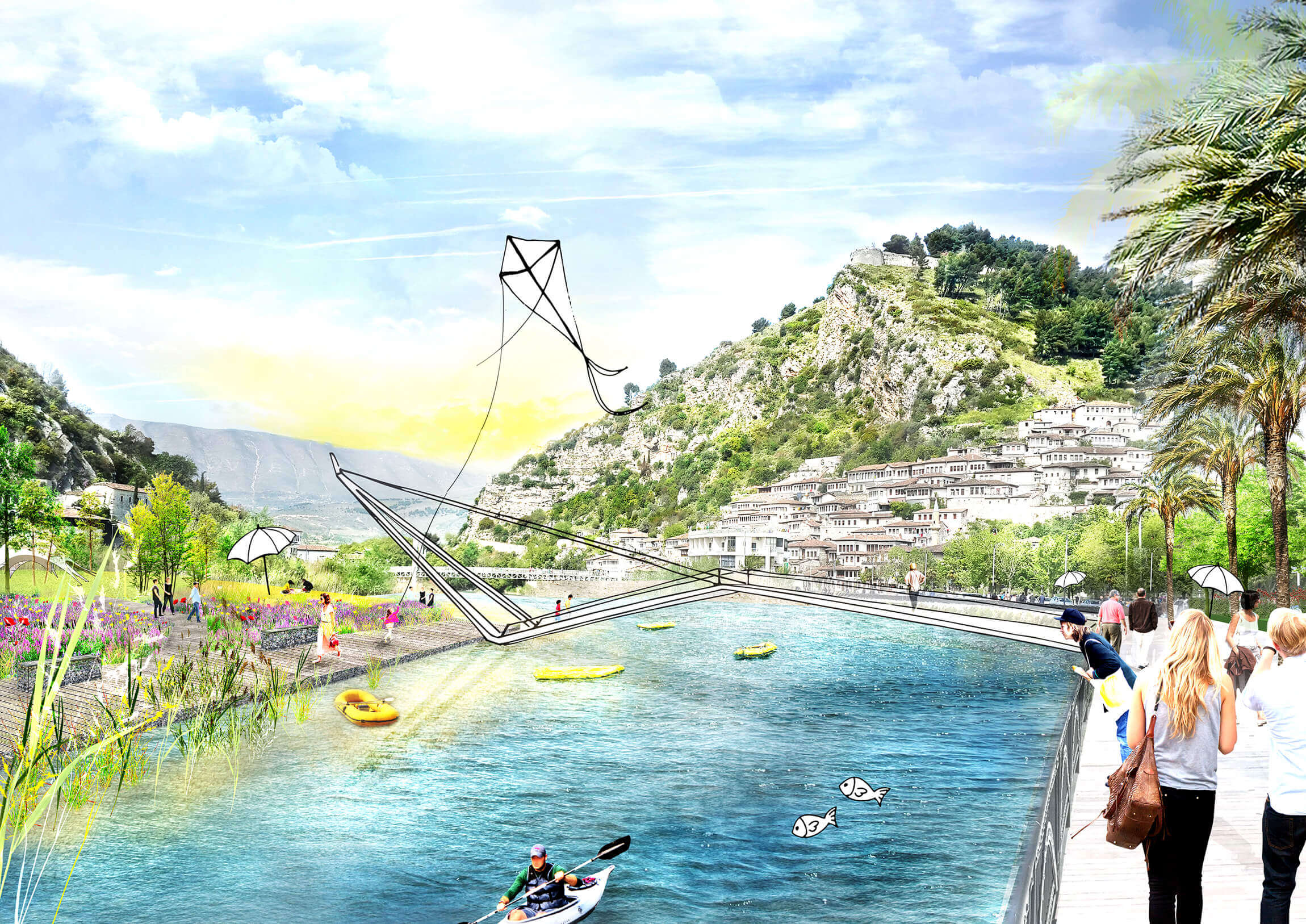
Berat is a UNESCO-heritage classified town, located in a mountainous center of Albania, along the Osum river. The seasonal variability in water discharge of the Osum river is large. During summer the river’s baseflow barely sustains a small stream, and the riverbed is filled with sandbanks covered by low quality vegetation and deposited litter. But in spring the steep river basin of the Osum can cause extremely high discharge levels. Due to these seasonal changes, the islands’ morphology is continuously changing. While these dynamics might be regarded as a characteristic feature of the Berat river, they also limit or even prevent actual use of the islands.
slider
Therefore, we guide the water stream of the Osum River in such a way, that it adds spatial quality to Berat in every season. Both with high and low water. In summer and autumn large flowering islands emerge by creating a concentrated river. In winter and spring, when the water level is higher, a landscape of wetlands arises. During peak moments, the river almost covers the whole riverbed, only leaving the highest islands untouched.


It is possible to create a better ‘guidance’ of the river by combining small interventions with the potential building capacity of the river: a controlled erosion and deposition of river sediment to create sandbanks and channels. Thus, by carefully introducing structures in the riverbed, we can use the river flow to create ‘islands’.

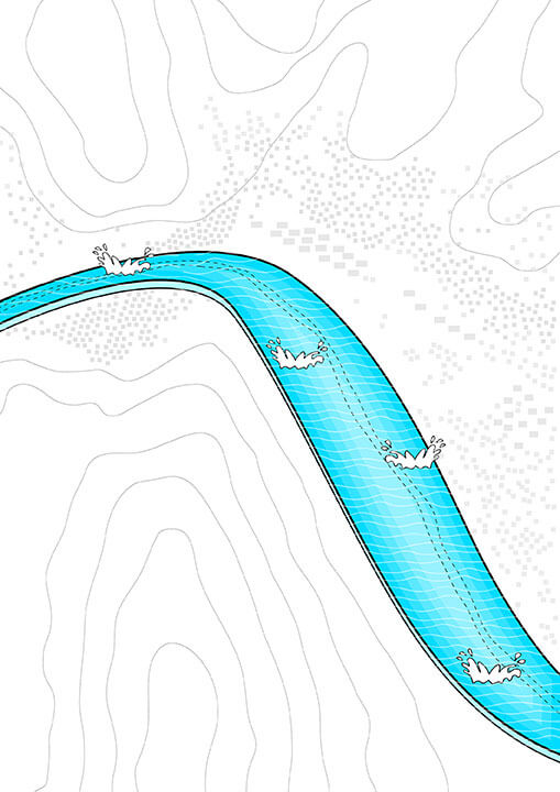
By guiding the river with a first system of low curbs, we ensure a minimal, steady streamflow during dry periods, and give Berat a river. Meanwhile these curbs create the contours of a first terrace level in the river.
A second system of higher curbs creates the perimeter of a second terrace level. It protects the crests of the existing sandbanks, and secures a set of stable islands when the water level is high.
By carefully positioning the structures in the riverbed, we are able to let islands shrink and grow, reaching a minimal footprint during winter and early spring when water levels are high, and a maximal footprint during summer when the water level is low.

During the summer, Berat becomes alive. The city is vibrant and tourism flourishes which means that the riverfront should add to the city’s scenery. A low curb in the riverbed directs the modest base flow into a single stream predominantly along the urban waterfront side. The curb-quays act as the perimeter of the largest set of islands: the first terrace level that becomes available when the sandbanks dry out during summer. These flower gardens exist only for a few months annually, creating a fabulous seasonal attraction.

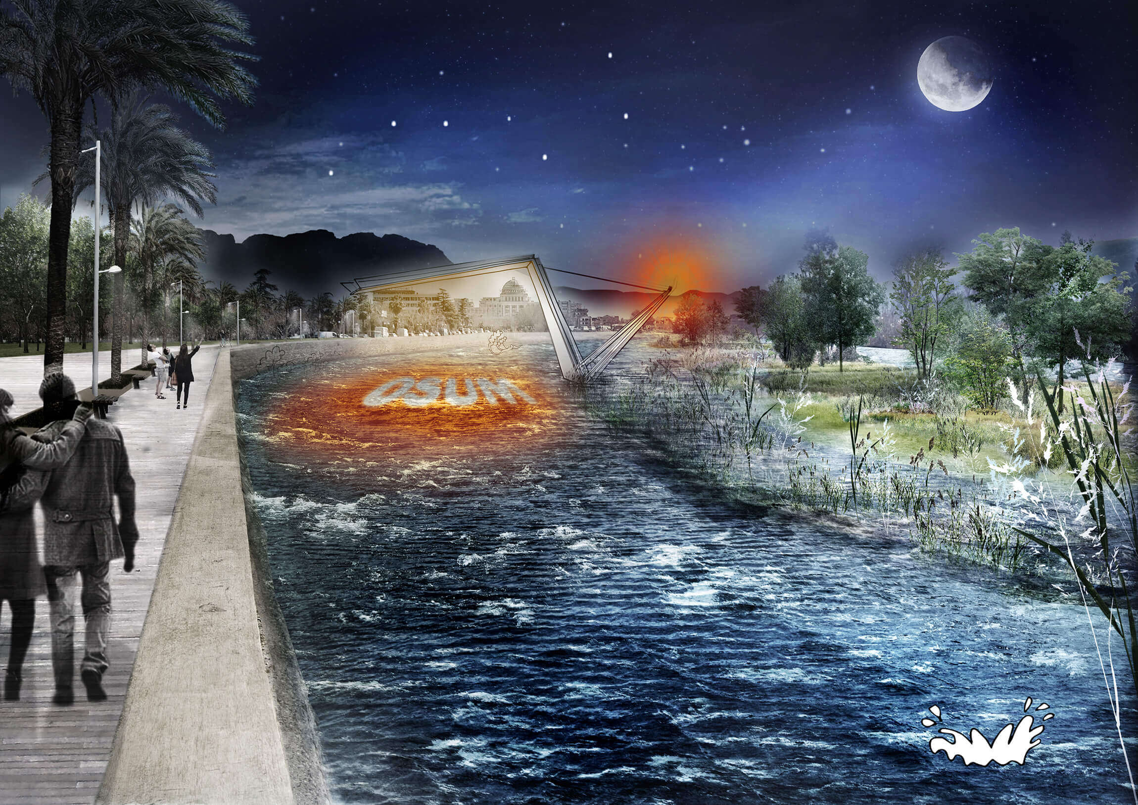
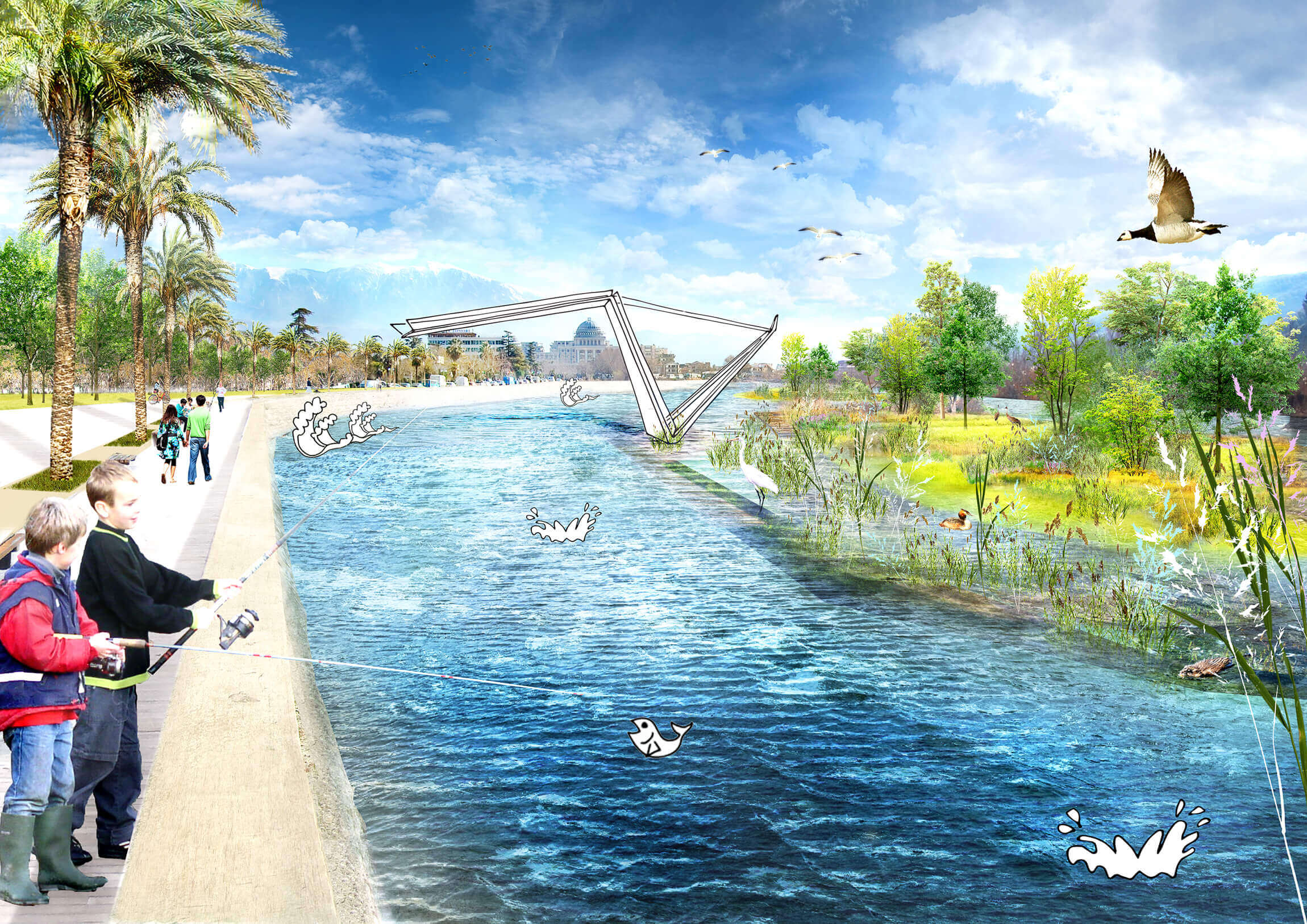
During winter and spring the discharge levels of the Osum River increase. The lowest curb level (and terrace) is overflown at certain spots, which effectively means that the ‘summer version’ of the Osum River is widened. The summer gardens are now gradually submerged and transform into seasonal wetlands. The flowering vegetation is overflown by small streams and ponds, and the reed vegetation is growing. The level of inundation depends on the flow rate of the river, and varies constantly through the season, creating an everyday changing landscape.

During certain periods in winter and spring, the water level in the Osum River reaches the highest stages. While the first terrace level, including the curbs that mark the perimeters, are overflown by water, a small set of islands remains, protected by the second curb system. This last set of plateaus is no longer accessible for pedestrians, providing a last resort for animals and birds within a now formidable river that almost covers the complete cross section.


Year
2015
Location
Berat, Albania
Type
Research, Landscape
Client
Atelier Albania
Municipality of Berat
Size
60 ha
Awards
2015 Competion 2nd prize
Publications
Team & partners
Marnix Vink
Michiel Van Driessche
Deborah Lambert
Carlijn Klomp
Willemijn van Manen
Fabrice Wack
Jean-Francois Gauthier
Laura Spenkelink
Alexandra Merkulova
Unesco IHE
Polis University