

K64 keflavík airport area masterplan
SETTING THE PATH FOR A LONG-TERM SUSTAINABLE DEVELOPMENT
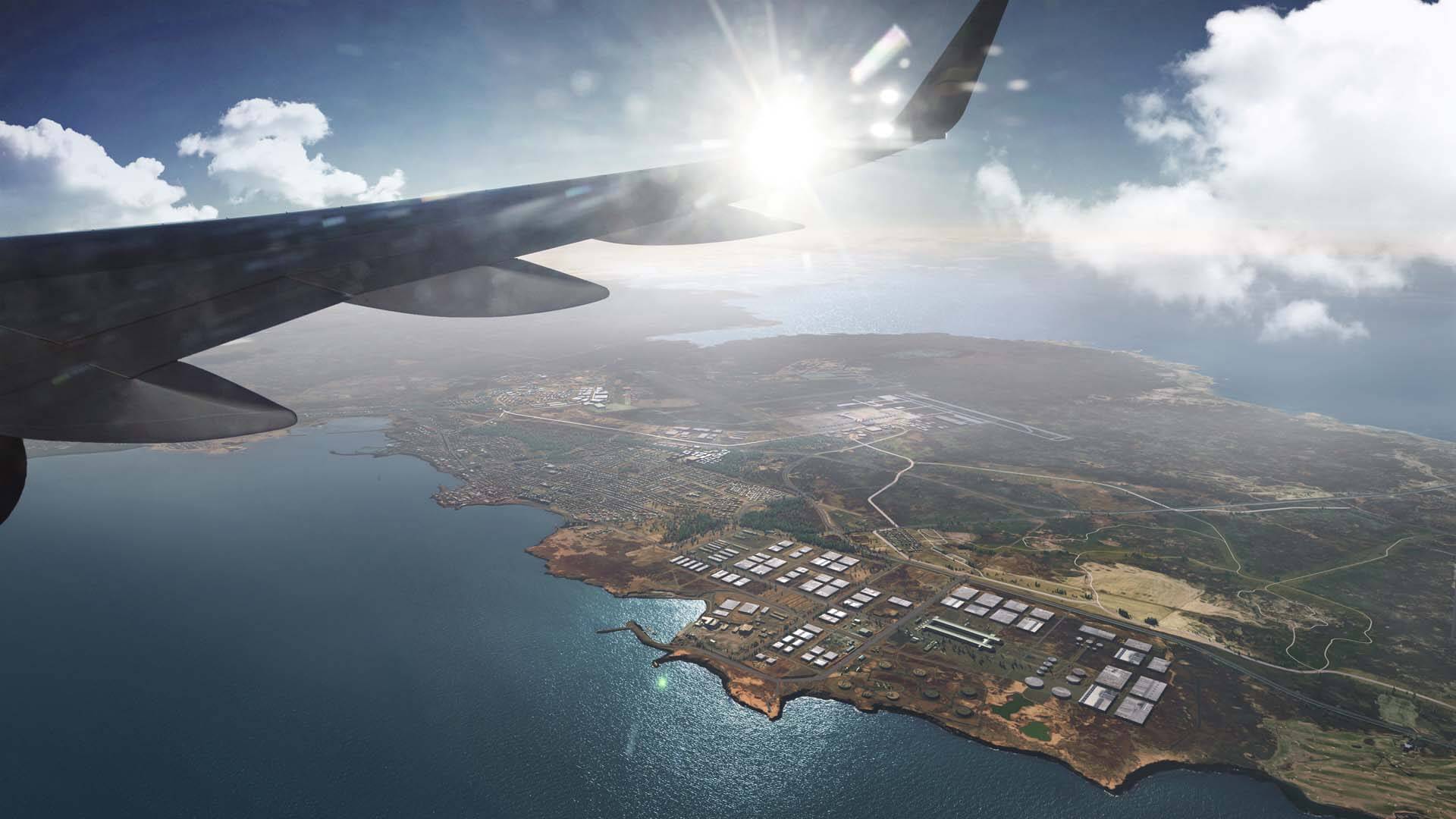
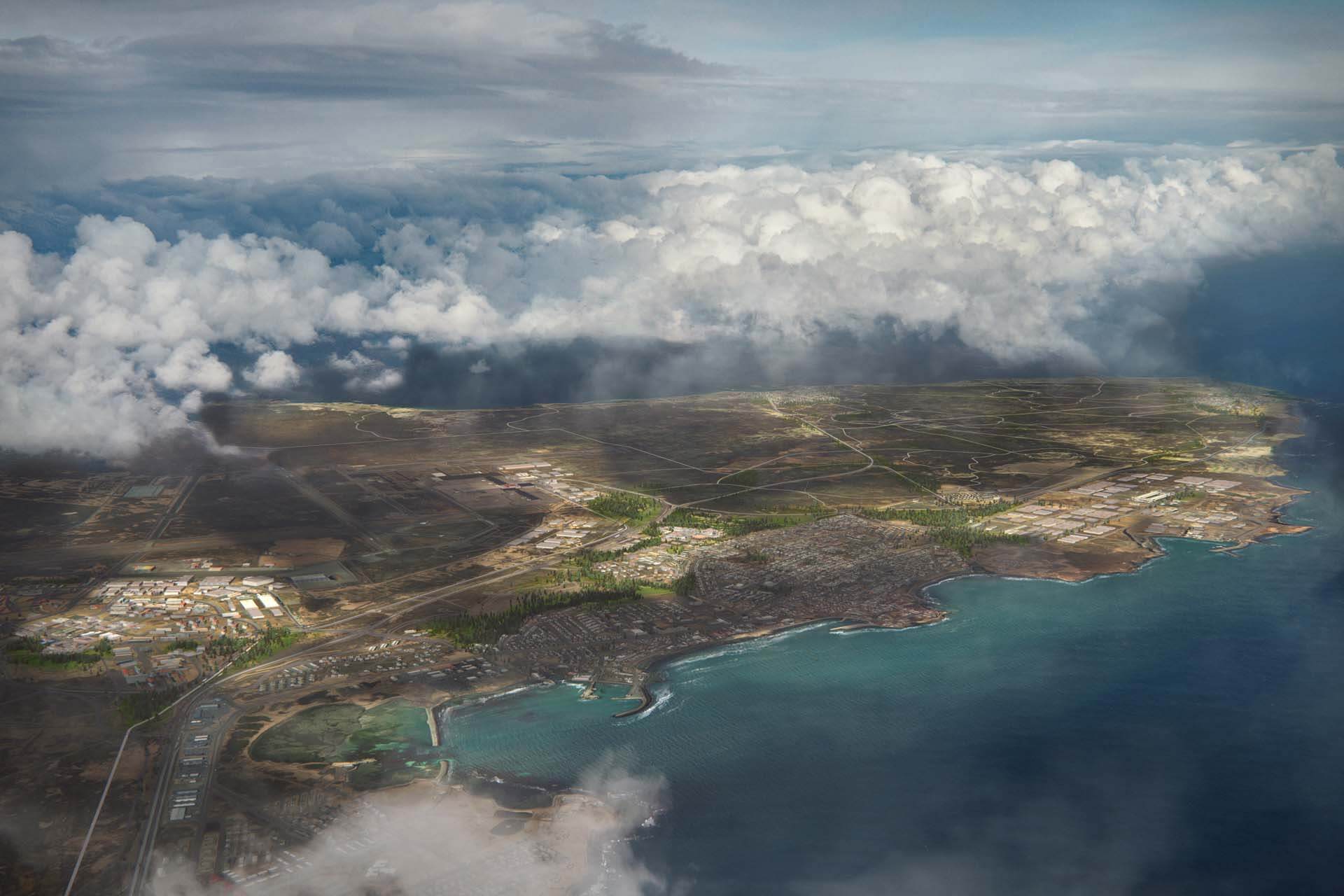
Located 50 km away from the capital Reykjavík, the Suðurnes peninsula with Keflavík International Airport is Iceland’s most emblematic gateway. Sitting at the crossroads of Europe and North America, home to the Reykjanes UNESCO Global Geopark, the airport area is exceptionally well suited to become one of the leading developments for sustainable innovation in the aviation, energy and technology sectors. K64 Keflavík Airport Area Masterplan will support Iceland’s net-zero and sustainability ambitions as well as exemplify United Nations (UN) Sustainable Development Goals (SDG). The design concepts promote health and well-being, appropriate densities, landscaping, and transportation, to create a sustainable city region of the future.
The masterplan has been developed by a multidisciplinary team led by KCAP, including FELIXX, WSP, MIC-HUB, VSO Consulting, Buck Consultants International, Buro Happold, Base Design, Maurits Schaafsma, and Kanon Arkitektar.
Spatial and economic masterplan

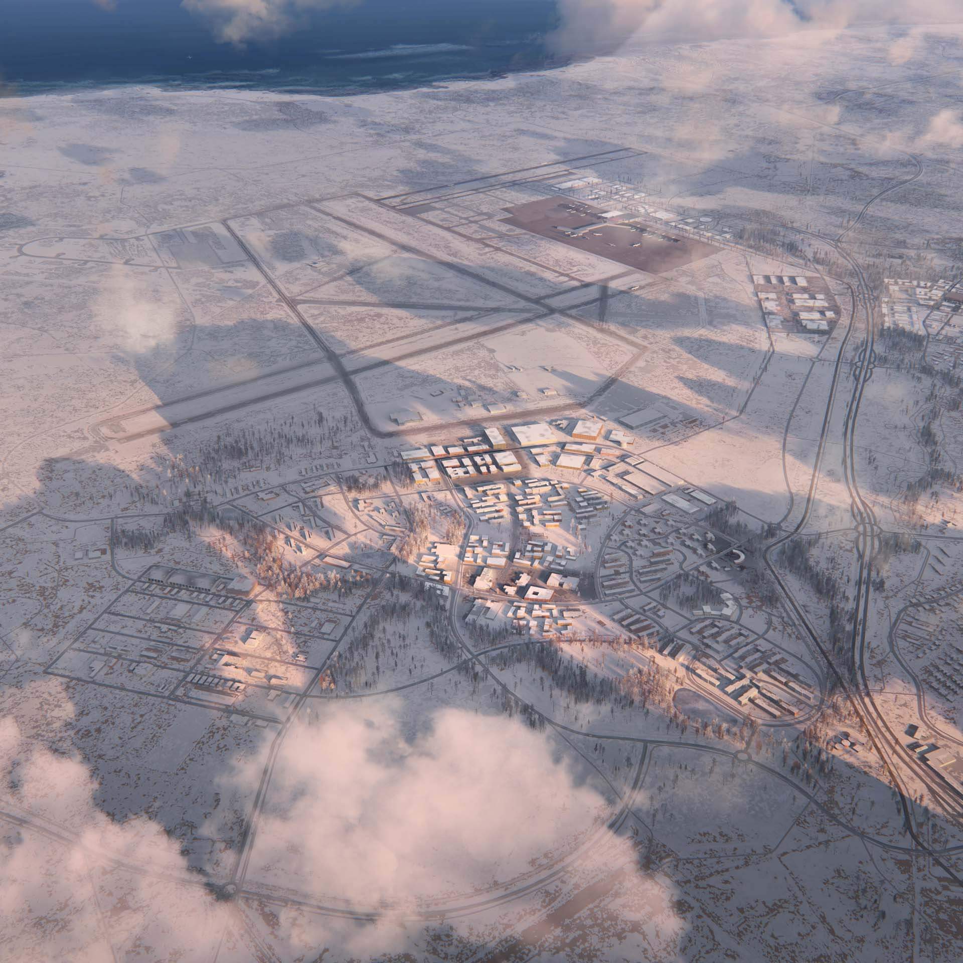
K64 proposes an incremental strategy to steer the long-term transformation of the Suðurnes peninsula. To set the path for sustainable growth, focus areas are defined that mutually reinforce economic activities and local communities. This urban framework is preventing sprawl by proposing compact urban development in three clusters anchored on the existing build-up context. It establishes a distinct spatial logic for airport related activities around the airport, supporting both population and employment growth.
Felixx is responsible for the landscape strategy within the masterplan, tying the ambitious economic development of the peninsula to the implementation of Iceland’s national forestation programs. These programs are building on the involvement of local communities, ensuring long-term climate sustainability while enhancing social networks.
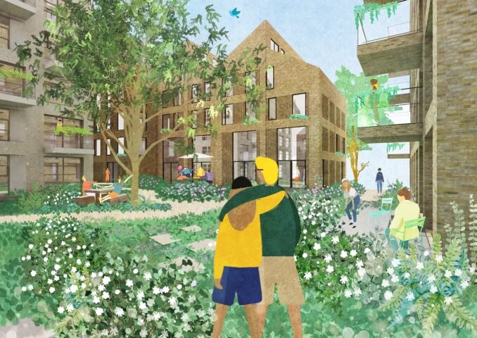
PENINSULA PARK

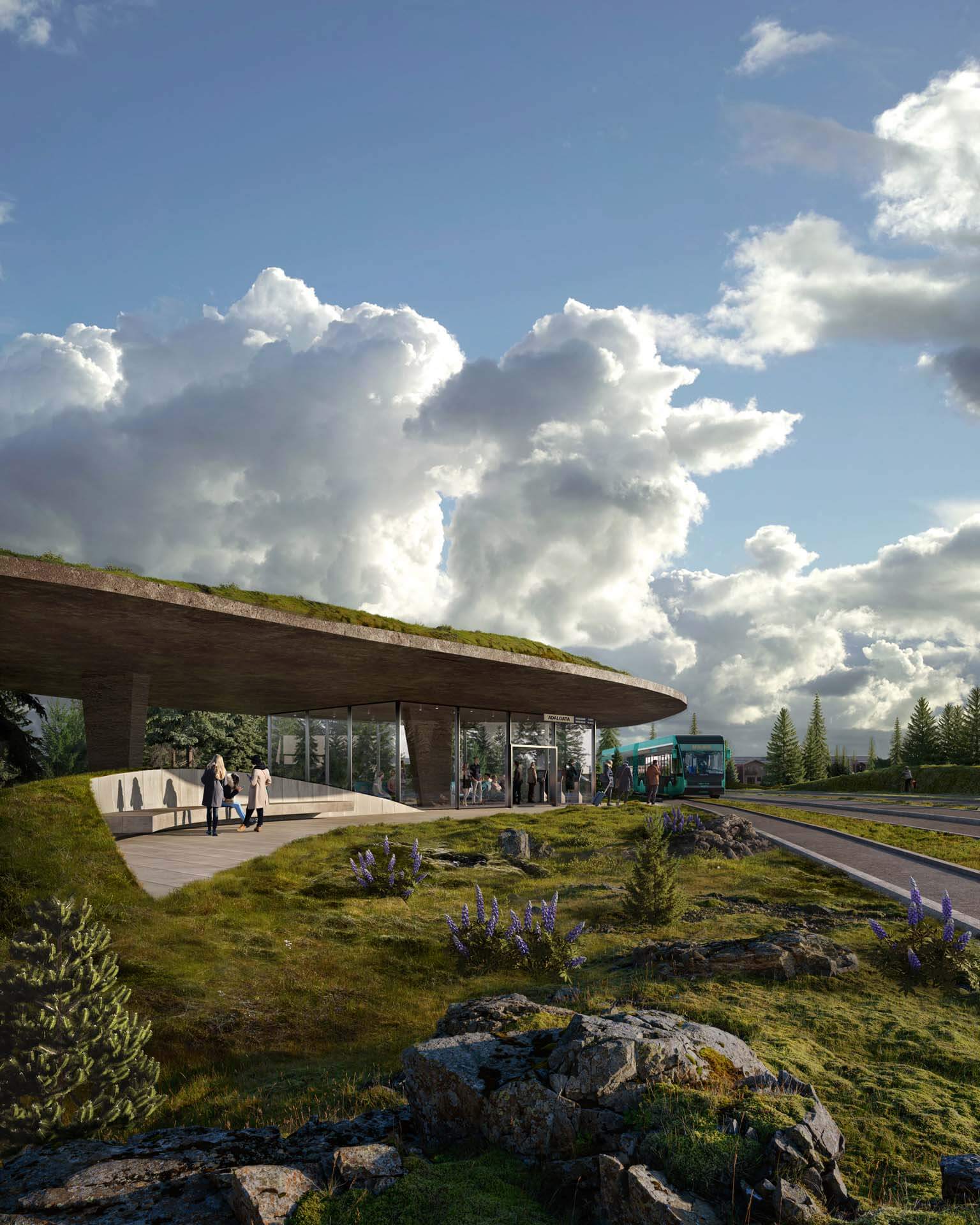
The vast landscape that currently separates the existing communities and new development clusters will grow into a uniting park. Organized as a network of nodes and linear elements, the proposed landscape will tie the entire peninsular together into a coherent whole referred to as the Peninsula Park. The landscape strategy takes the concept of afforestation as its basic premise to mitigate the harsh climate and create comfortable conditions that allow for shared programs, outdoor facilities and cycling networks. The park will bring back the original nature of the peninsula reintroducing trees as a strong part of its identity. It will connect communities, mitigate wind through landforms and afforestation. Cleaner air, less wind, new opportunities for sports, recreation and learning will improve the liveability of the area for all generations, strengthen the culture of active outdoor use.
integrated ecosystem

To sustain the K64 initiative over time, urban, landscape and mobility strategies intertwine in an ecosystem that fosters stronger synergies between the economic and social fabrics of the peninsula. Resilient transport networks and increased public transport services, including a peninsula wide DRT offer, improve the local connectivity between the urban nodes. A high-speed connection to Reykjavík through a KRL line embeds the archipelago into the capital’s mobility system. The energy strategy strives for diversification and decarbonisation of local energy systems while generating economic development with innovative solutions for the mid to long term. These spatial strategies are underpinned by economic strategies for industries, knowledge and cargo development to create a resilient and diverse industrial base, develop business opportunities for green and hi-tech activities, and ultimately create an international competitive business destination.
Afforestation as a connecting agent
Landscape identity
Nowadays, Iceland is one of Europe’s least wooded countries, but in ancient times large forests covered the coastline area. The country lost most of its trees more than a thousand years ago, when Viking settlers deforested the area, turning it into agricultural land. The landscape became subject to vast erosion, creating the rough and rocky landscapes we currently know. Although it appears completely natural, the open-view landscape of the Suðurnes peninsula is a result of several centuries of simultaneous human activity and wind action mixed with salt storms.

In the face of global warming, reforesting the country’s territory has become a priority of the Icelandic government. Afforestation is recognized as a key strategy to address the increased impact of wind erosion and a crucial instrument to meet the Icelandic climate goals. The landscape strategy for the Peninsula Park uses afforestation as a means to mitigate the climate, meanwhile creating a shared identity that refers back to the historical landscape of Suðurnes.
Landscape framework

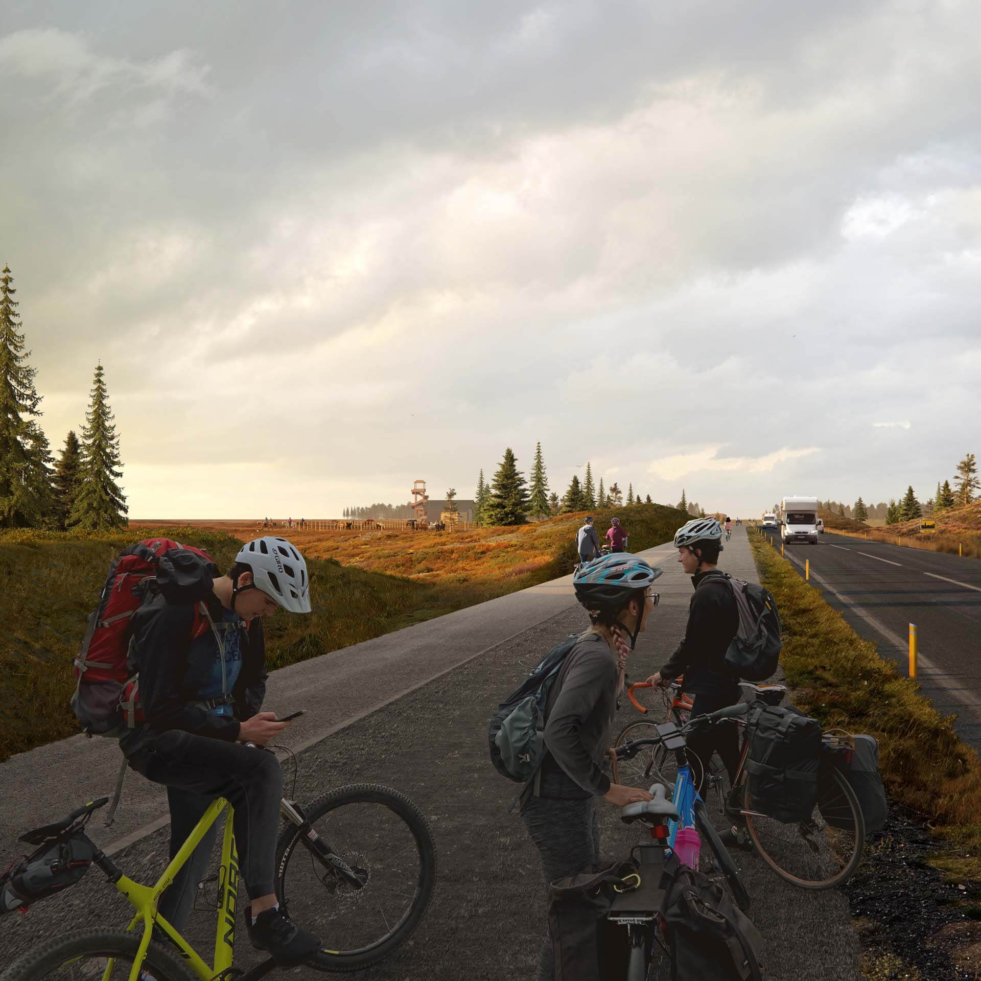
The backbone of the Peninsula Park is formed by networks for walking, hiking, biking and horse-riding. They enhance and connect existing trails and circuits, strengthening the physical relation between different communities and the airport. Programmatic nodes activate these networks of alternative mobility. The peninsula contains unique natural and man-made landmark ‘nodes’ - points of interest for locals and visitors. New nodes will increase traffic and improve the overall quality of the outdoor experience, adding up to a system of social facilities and embed existing public amenities. A series of landforms, berms and larger forest patches mitigates the wind and improves the environmental comfort along the routes and shelters the nodes.
Landscape strategy
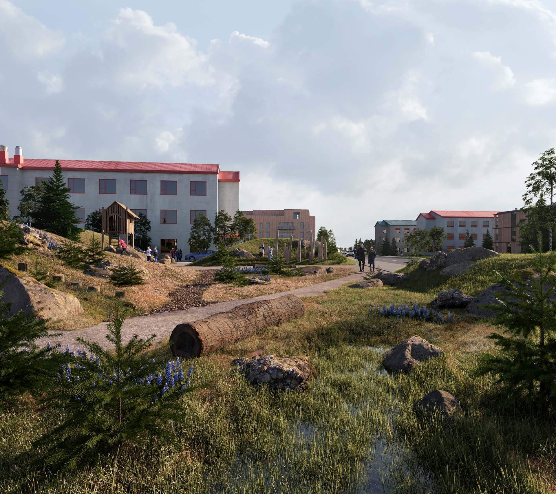
Inspired by the traditional Icelandic turf house, landforms become a natural part of the landscape and make afforestation possible. The land is sculpted with small hills and ribs, to create protected zones against the wind. On these zones, trees can be planted and sown, allowing them to gradually turn into forests.

The creation of this new sculpted landscape is linked to all new developments on the peninsula and functions as a social catalyst for the existing communities to improve their amenities. Mitigation landforms protect bike paths and walking trails from the winds, create public spaces inside urban, shelter public transport hubs. Every individual development contributes to the realization of the new Peninsula park.

Toolbox for implementation
Park sections
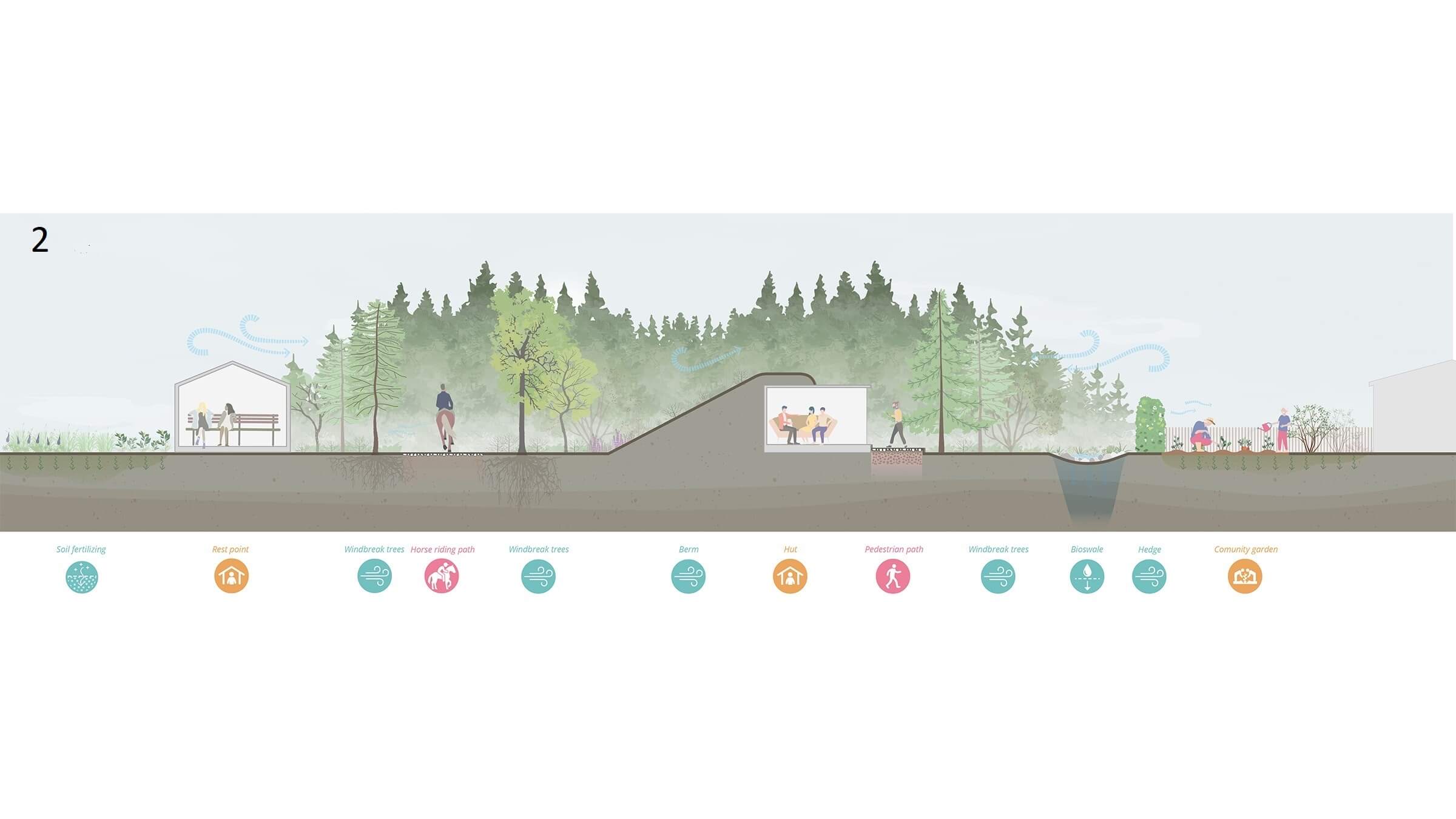
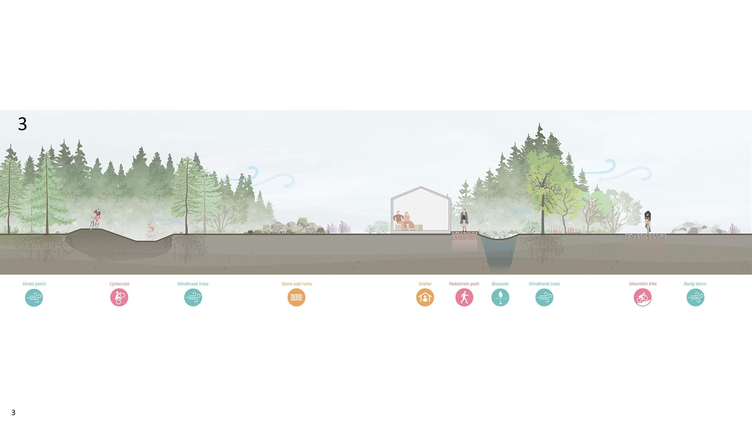
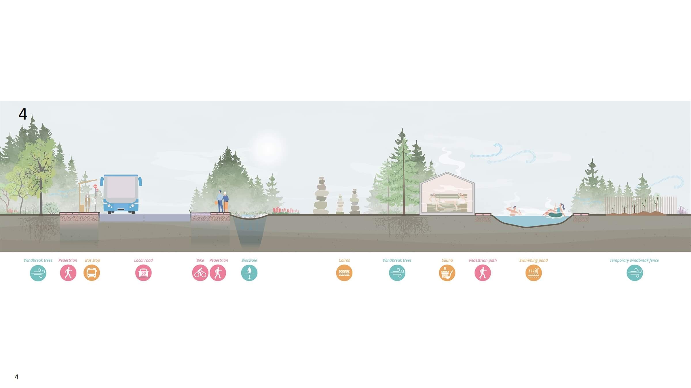
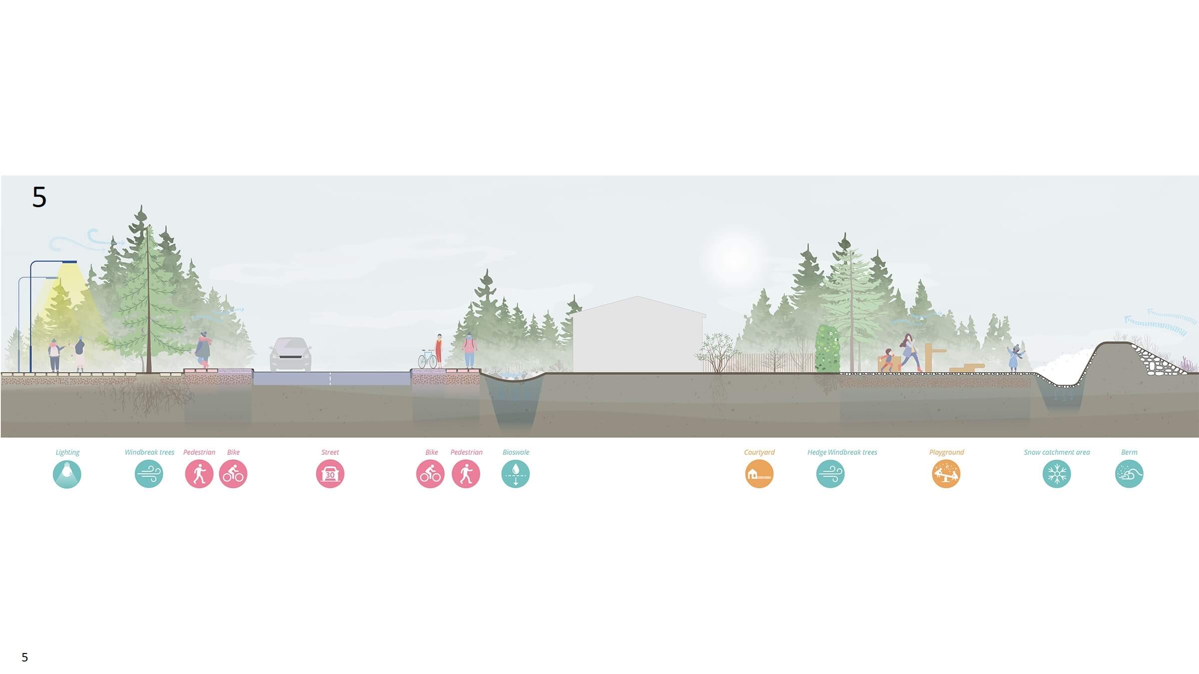
slider
- Mitigation landform protecting the KRL, the bike paths, and the walking trails from the winds, with a bioswale collecting stormwater runoff and/or snowdrift.
- A forest corridor offering a bridle path, with a mitigation landform containing a rest station, inspired Icelandic turf houses or ‘torfbæir’. Back yard of a house with hedges protecting a small gardening plot.
- A forest corridor offering mountain biking, with a restored wetland and rest station. A high-speed racing bike path is well protected from the wind and separated to avoid mobility mode conflicts and provide safety. The forest forms an understory growth that enriches its value for biodiversity.
- Transportation stops, existing and future attractions around the peninsula become the nodes in the network protected by afforestation. Health-oriented functions become particularly popular as landscape connectivity increases. Natural and man-made landmarks improve navigation in the Peninsula park.
- Inspired by the town of Selfoss, mitigation strategy extends afforestation inside the urban areas offering protection from wind for streets, public spaces, neighborhoods and homes. Water and snow management are incorporated into the landscape and become as much a natural part of its identity as the landforms and the trees. Lighting and navigation improve safety and promote extended use of the landscape network.
Park zones

- The aptly named Gateway to Iceland traces a welcoming journey starting from the commercial and visitor amenities of the Airport Forecourt all the way up to the Aðalgata area, a nodal point marking the entrance to the city of Reykjanesbær. Together with the adjacent Diamond Gate logistics hub, Aðalgata is forming a highly dynamic district mixing residential, community and R&D programs.
- On the southern edge of the airport, Ásbrú is thought to become a campus-like area, fostering aviation activities and R&D, start-up programmes, light industries and most of all an ambitious residential densification, that turns the former NATO settlement into a neighborhood in its own right, a modern take on the cosy, lively village.
- North of Reykjanesbær, the focus area of Helguvík will do the heavy lifting in terms of eco-industrial development, converting the existing port and manufacturing infrastructures to create a circular-economy environment comprising a construction hub and a Sustainable Aviation Fuel (SAF) facility, with the potential to spearhead energy transition in Iceland and beyond.


Year
2021 - 2023
Location
Keflavik, Iceland
Type
Masterplan, Infrastructure, Landscape
Client
Kadeco (Keflavík Airport Development Company)
Size
5500 ha
Awards
2023 The Plan Award winner
2021 Competition winner
Publications
www.k64.is
Architectenweb
Architectuur.nl
World Landscape Architecture
Global Construction Review
Team & partners
Michiel van Driessche
Deborah Lambert
Marnix Vink
Cherk ga Leung
Marina Višić
Nadya Nilina
Eduardo Marin Salinas
Shuangyun Chen
KCAP
WSP
MIC-HUB
VSO Consulting
Buck Consultants International
Buro Happold
Base Design
Maurits Schaafsma
Kanon Arkitektar
Plomp