
Dharavi Mumbai
Street-led Slum Upgrading
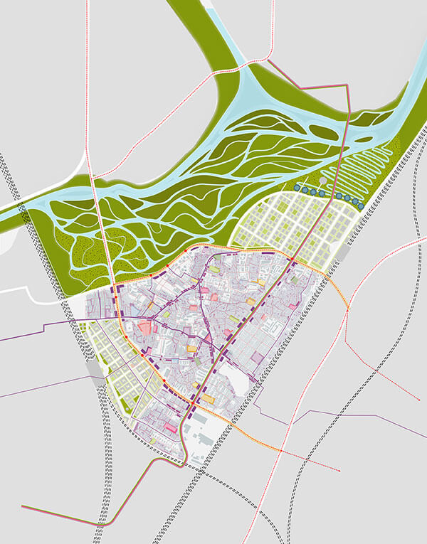
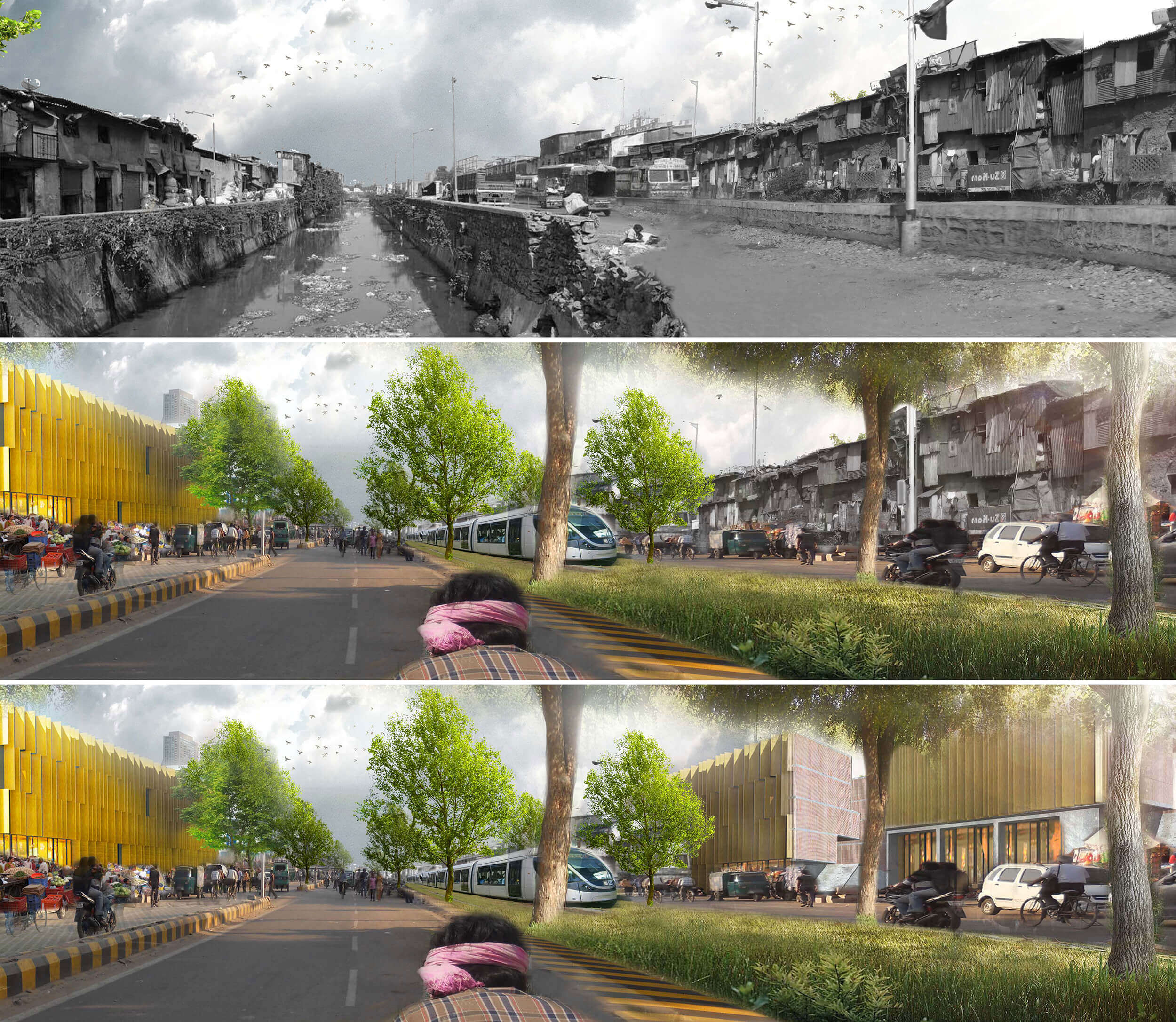
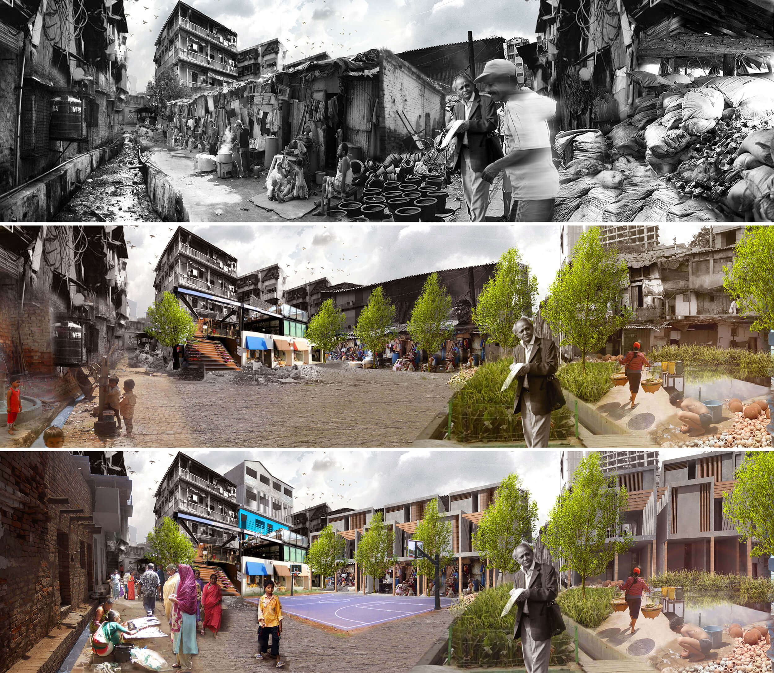
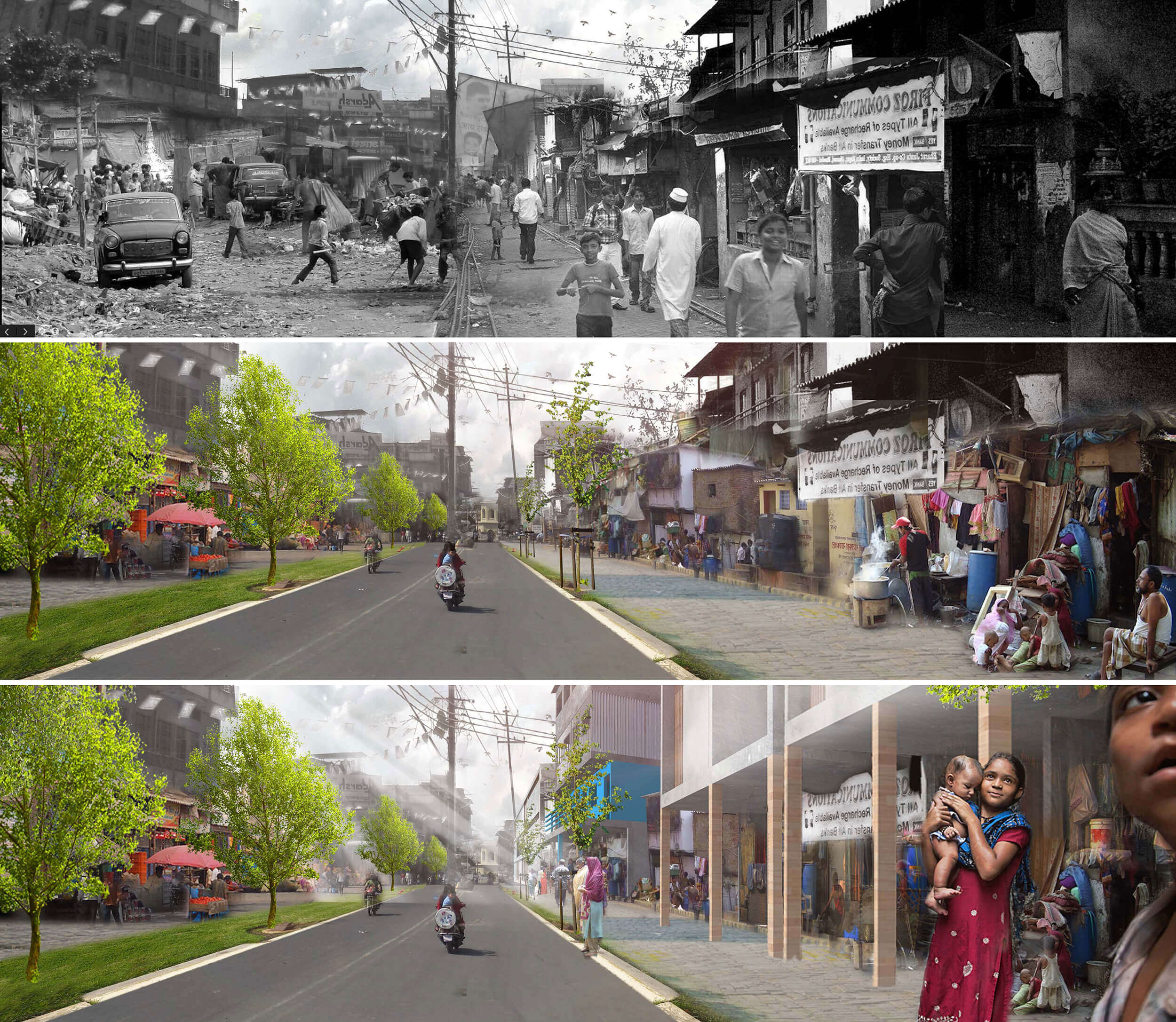
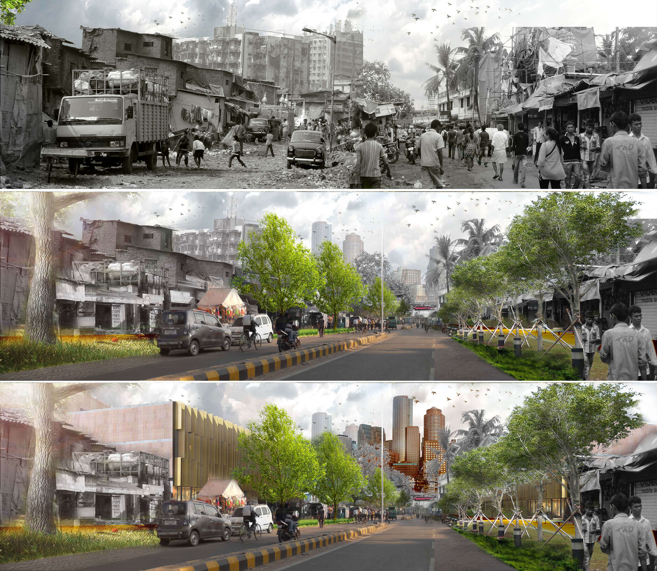
Dharavi is the largest informal settlement of Mumbai, and one of the biggest slums worldwide. Its central location in Mumbai’s metropolitan region puts a high pressure on the area, resulting in bold plans during the last years for the development of a glamorous urban district.
Felixx developed an alternative strategy, building on the paradigm shift in the common approach towards slum upgrading. Boundary defined redevelopment projects are replaced by citywide strategies. Slums are no longer considered isolated islands of poverty, but rather deprived neighborhoods within the city. They are an integral part of the overall city system, but spatially segregated due to the absence of streets and open spaces.

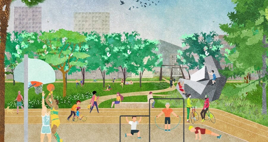
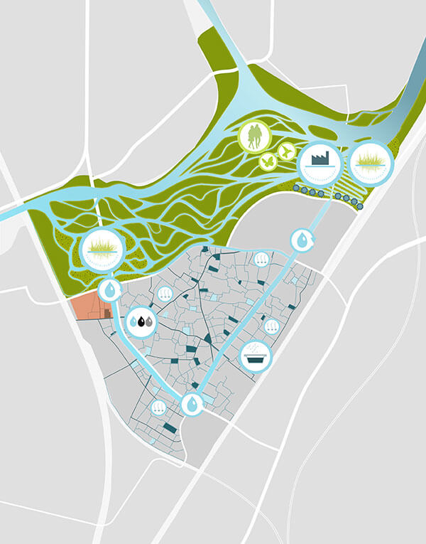
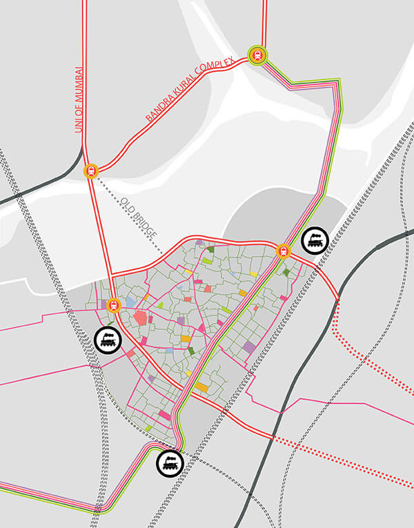
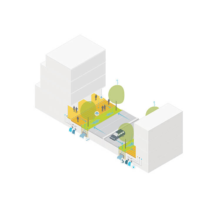
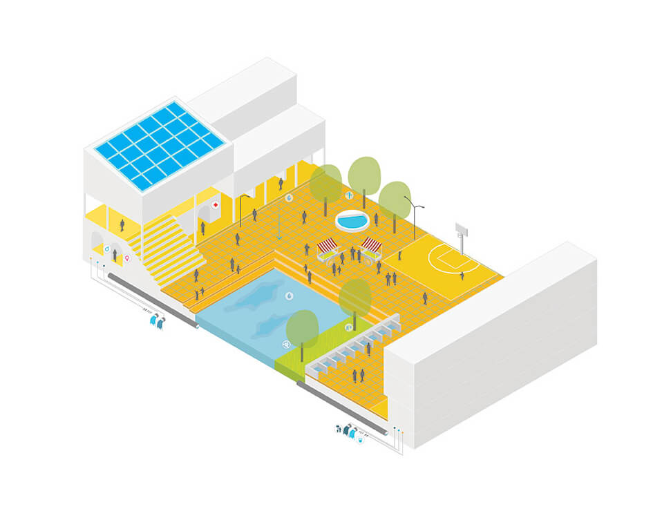
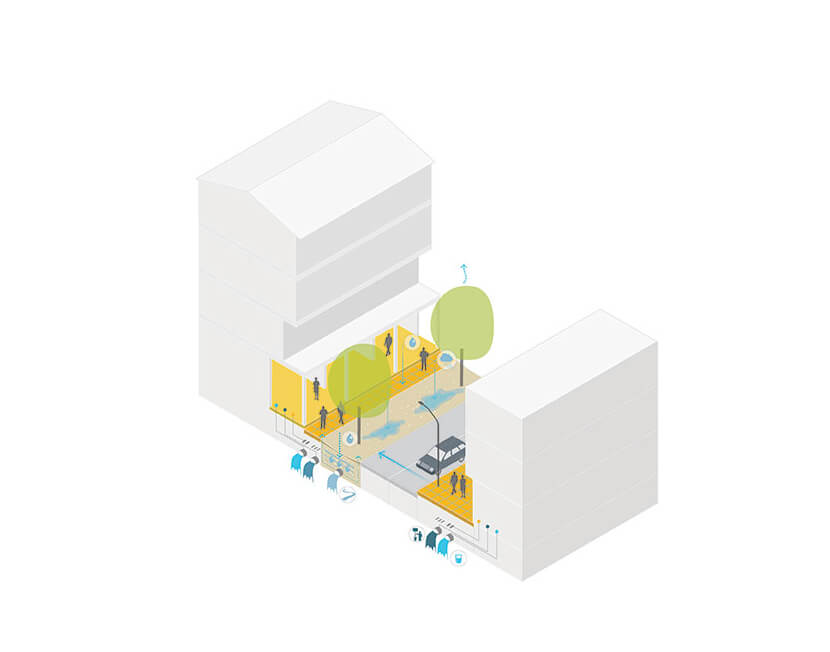
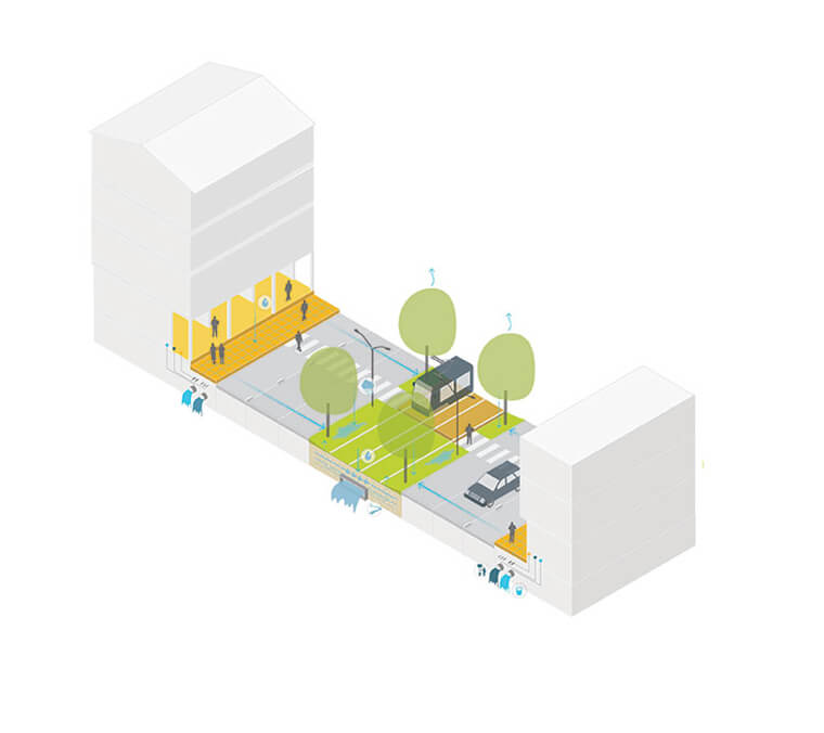
By investing in the common good and upgrading public spaces, the plan aims to reintegrate Dharavi into the city and facilitate gradual redevelopment. This street-led approach consists of three strategies, dealing with infrastructure & mobility, water & sanitation and regeneration & development. All measurements are integrated in the redesigned streets. Existing streets are up- and downgraded into a hierarchic network, allowing for different traffic modalities to be used. Different water structures are connected to prevent stagnant water and drain it to the river. Infiltration zones slow down rainwater runoff, sewage networks collect waste water, and clean water supplies are provided to make Dharavi a healthy and climate proof place. The upgraded streets connect neighborhoods, businesses and social activities. They formulate the base for legislation, enabling every company and household to get an address. Central squares in each neighborhood establish social and economic focal points. These places formulate new identity carriers and allow for the celebration of the diverse characteristics within every single community of Dharavi.
slider
The three strategies are integrated into a dynamic public space framework, controlling the different strategies within a participatory process. The framework deals with a variety of interests, from local entrepreneurs to international developers, and connects different scale levels, from Mumbai Metropolitan Region to Dharavi’s different nagars. As such it serves as a tool to outline these different aspects within an extensive participatory process. It serves two main goals, it boosts gradual redevelopment by identifying public space qualities, and it sets conditions for these developments by determining the capacity of the infrastructural network. As a game board, the public space framework shows the meaning and influence of different measures, how they could strengthen or preclude each other. Connecting different scales and interests into a balanced and supported framework.


Year
2014
Location
Mumbai, India
Type
Research, Masterplan
Client
Size
217 ha
Awards
2014 Competition Honorable mention
Publications
Architectuur.org
The Guardian
Architecture Lab
LAN-India
Landezine
Team & partners
Michiel Van Driessche
Marnix Vink
Deborah Lambert
Willemijn van Manen
Carlijn Klomp
Laura Spenkelink
Steven Broekhof
Studio OXL
IHS Erasmus University
Nasvi
Paul van Kerkoerle