Almere Centre Vision 2040
Where Densification Strengthens Nature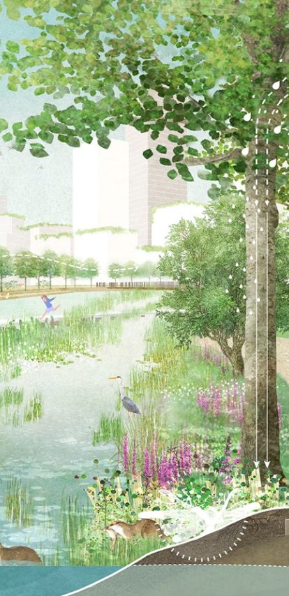
Almere is one of the youngest cities in Europe. It was laid out from the 1970s on polder land newly won from the sea, and everything about it is made: its ground, its water, its forests, its centres. That is where its character comes from. Almere takes its identity from its landscapes, and it was organised as a prototype garden city: low-density urban cores in an extensive green-blue network. The network gives the city its character. What it lacks is interaction — the cores and the network sit side by side, and little passes between them.
Now the city is growing from 220,000 to 350,000 inhabitants, and its centre has to carry a large share of that. For the Municipality of Almere, Felixx and PosadMaxwan developed the vision for that growth: 500 hectares around the Weerwater, in which the central lake becomes the new centre of the city and the landscape sets the terms for everything built around it.
Key info
- Year
- 2022 - 2023
- Type
- Masterplan, Vision
- Size
- 500 ha
- Location
- Almere, The Netherlands
- Client
- Municipality of Almere
- Status
- Approved
From garden city to nature-based city
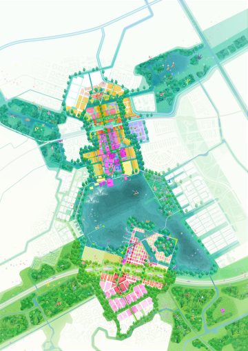
Almere has been planned twice before. The garden city came first, with its cores as equals in a shared landscape. In the 1990s the OMA masterplan brought hierarchy, and turned the central core into the city centre. This vision is the third plan, and it turns the order round: the landscape the city grew from now organises its growth.
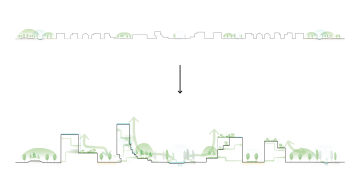
The question is precise. Almere's centre has an intercity station, a full set of amenities and one of the least populated cores of any Dutch city. At least 5,000 homes are planned there by 2030, and up to 15,000 by 2050. How do you densify a garden city in its main core? Instead of widening the gap between built cores and landscape, the vision uses the densification to close it.
The Weerwater as the new centre
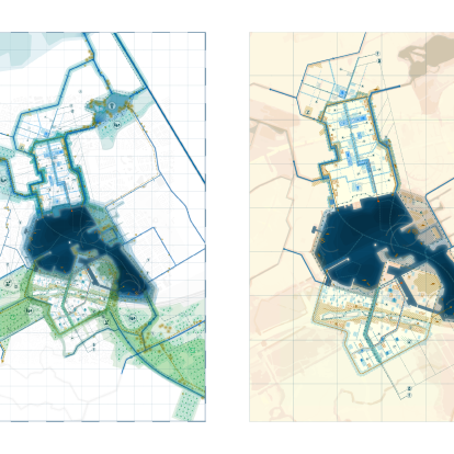
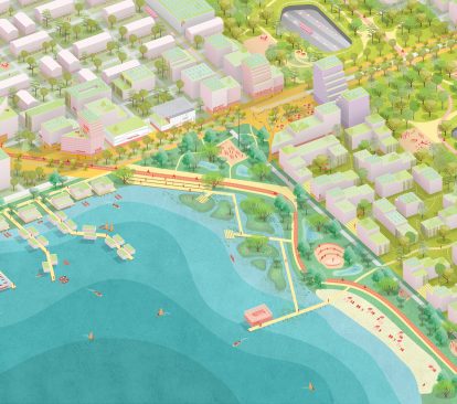
The centre moves onto the water. The Weerwater is already the heart of Almere's green-blue network, the lake the city's canals and parks run to. The vision makes it the core of the centre as well. The existing core on the north shore and a new core on the south shore both reach towards the water and merge with it. What was an edge between two cores becomes the heart of both.
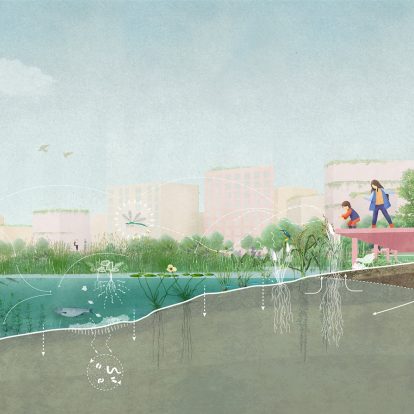
The lake works in two ways at once. As ecology, it is the strongest link in the network of water and green that runs through the whole city: cleaner water, living banks, more species. As a place, it is bathing water, room for events, a shore to walk and sit on, and the connecting spine between the education and innovation clusters on either side. One body of water carries the ecosystem of the city and the daily life of its centre.
From ecosystem to framework
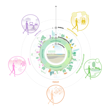
Making a lake the centre of a city starts with the ecological basis. Below ground, that basis is the water and soil system: how it performs today, how it will have to perform under the climate scenarios ahead, and how it should transform to get there. Above ground, it is the living system — the ecosystem corridors that run through the area, the biodiversity they hold and the pressures on it, and the structures that have to be in place to secure and organise them. Together, the two set out what the landscape can carry, and where.
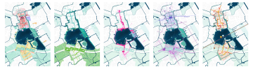
That basis becomes structure. It is drawn as the green-blue network the ground and the water can sustain, and on that network stand five development frameworks. The landscape framework comes first: the lake, canals, parks and planting the ecosystem can support and the city can build on. Four follow, each fitted to the landscape.
Urban development goes where the ground can take it and where water and green gain from it. Mobility follows the green-blue lines. Cultural programming lands where the landscape gathers people. Energy systems run where the ground allows. Laid over one another, the five frameworks are the plan. The landscape is the constant, and the other four are arranged by it.
The spaces it makes
Worked through to the ground, the frameworks produce a centre that is experienced as landscape from the water inward.
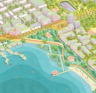
It begins at the Weerwater. The shore is a place in its own right: people swim from it in summer, walk it in the evening, cross between the two halves of the centre along it. Events gather at the water's edge, and the lake is what both districts look out on.
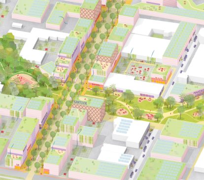
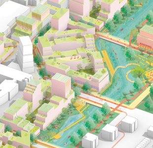
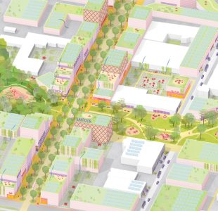
From the shore, two parks lead inland, one on each side. To the north, the Stadsweteringpark lifts the existing singel structure into a park that organises the historical core, with the Station District inside it — housing, culture and enterprise around the intercity node. To the south, capping the A6 ring makes room for the Forest Park. Where the motorway cut the city off from the landscape there is now forest, and the Forest District — innovation, sustainability, the circular economy — is built into it.
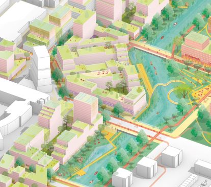
The streets carry that landscape on, and each district takes its identity from it. In the north it is water, taken as far as it will go: rainwater storage, canals and streams are joined into one network of wadis, seating spots and walking paths, so a walk through the historical core is a walk along the water. In the south it is trees: the streets are planted with lush vegetation, and the planting sets the hierarchy of the street network and makes places to stay along it. The dense centre reads as a district in a park.
And it reaches into the blocks. New development on the south shore, densification and transformation of the historical core on the north: in all of it, green and blue run into the programme. Roofs, gardens and courtyards, pocket squares and neighbourhood parks carry the landscape inside, so the buildings become part of the landscape they stand in. Profiles show how that works in one street section — water, soil, green, buildings, movement and energy sharing it — and axonometrics show it at the scale of the district. Each phase of growth adds to the system.
Buildings and public space merge into one adaptive urban landscape.


A method made public
Almere's vision shows that a city can grow and its nature can grow with it, and that Nature-based Solutions can be the primary instrument of that growth rather than a finishing layer.
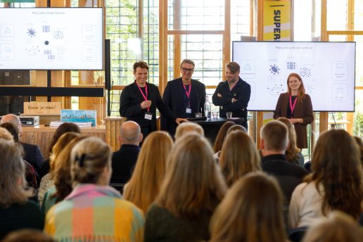
To share how, Felixx, PosadMaxwan and the Municipality of Almere organised the symposium De Groene Stad van de Toekomst — The Green City of the Future — on 3 October 2024 at The Natural Pavilion in Almere. Policymakers, researchers and urban planners from the Netherlands and Belgium came together for a day on how to make dense city centres natural and future-proof. The programme brought keynotes by Jessica den Outer, Alexander D'Hooghe, Han Dijk and Michiel Van Driessche, a presentation of the Almere vision, and knowledge sessions in which several cities put their own work on the same question side by side.
Working together
Felixx and PosadMaxwan developed the vision together for the Municipality of Almere between 2022 and 2023. The college approved it and presented it to the city council on 4 April 2024.
Want to learn more?
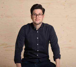
Elan Redekop van der Meulen
Associate partner, landscape architect, researcherElan is a landscape architect who graduated from Delft University of Technology with a bachelor's degree in Architecture, Urbanism and Building Sciences, and a master's degree in Landscape Architecture. Since 2018, Elan has been working at Felixx, having previously gained experience at wUrck Architecture, Urban Planning, and Landscape Architecture. Elan leads the landscape and strategy team and specialises in large-scale strategic projects with a focus on climate change, biodiversity and water-related challenges. In 2023, Elan joined the management team at Felixx as an associate.
Knowledge Hub
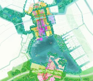
Development Plan Almere 2040
By 2040, Almere's city center will evolve into a vibrant, green, and urban hub. Commissioned by the municipality, Felixx + PosadMaxwan have developed a bold vision that embraces densification as a tool to strengthen nature. Rooted in nature-based solutions, the plan aligns programmatic ambitions with Almere’s unique ecological landscape. Strategic design around open water, interwoven with canals and parks, lays the foundation for a dynamic urban setting where living, working, learning, and leisure coexist in harmony.
The Development Plan sets the course for this transformation.
More info
- team
- Felixx
- PosadMaxwan
- photography/visuals
- Felixx
- awards
- 2025 Loop Award [winner]
- 2024 NVTL Award [nominated]


