Strategic Green Plan Leuven
Leuven grows from its landscape again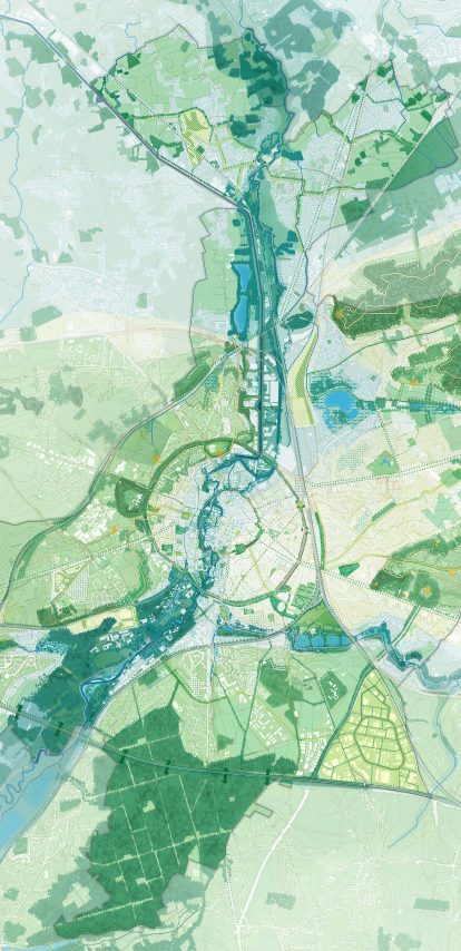
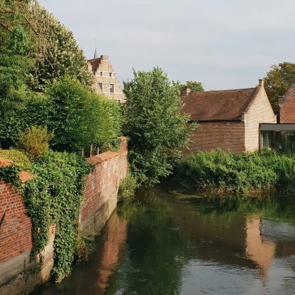
Leuven lies in a natural basin between the Hageland and the Brabant Plateau. The city grew around the River Dijle, a fine network of stream valleys and fertile soils. Those systems decided where people settled, farmed and built. Over the last century urbanisation loosened that tie. Rivers were canalised, open land fragmented, and green withdrew into parks and isolated public spaces. The systems underneath still decide how water moves through the city, where heat gathers and where biodiversity can hold. For the City of Leuven, Felixx and Witteveen+Bos wrote the Strategic Green Plan to put those systems back in charge of how the city develops. The College and the City Council approved it unanimously in November 2024.
Key info
- Year
- 2023 - 2024
- Type
- Masterplan, Vision
- Size
- 5751 ha
- Location
- Leuven, Belgium
- Client
- City of Leuven
- Status
- Approved
The question
The usual question for a green plan is where more green can be added. Leuven's plan asks how the city can once again develop from its landscape. That changes what green is. It becomes the structure through which climate, water, biodiversity, health, recreation and food are handled together. Each of those is a claim on the same scarce space. Handled one by one, they compete. Handled through the landscape, they reinforce each other.
The landscape as it works
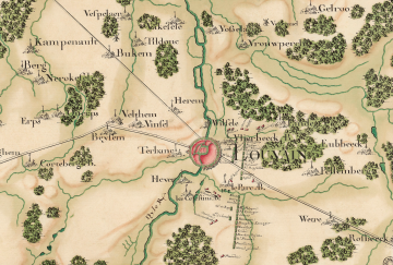
The plan begins with the systems that have shaped Leuven for centuries: its geomorphology, hydrology, soils and ecological structures. Read together, they are the city's inherent landscape framework, and they still govern how it functions. They show where water can be held, where biodiversity can develop, where cooling is most effective and where urban growth can strengthen a natural process instead of cutting across it. Once they are drawn and named, they become the basis for development.
From ecosystem services to one green plan
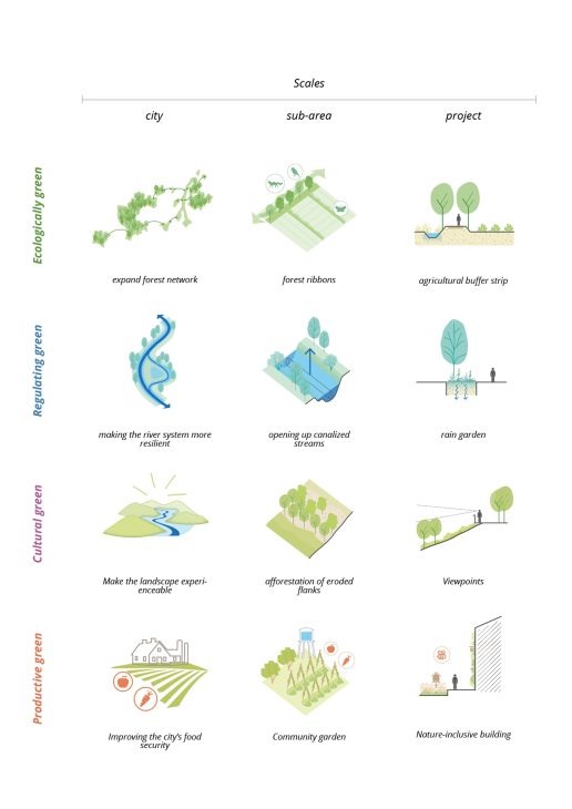
The plan works with ecosystem services: what an ecosystem does for the people around it. That makes the landscape's value measurable, and comparable with every other claim on space. Four kinds. Provisioning — food, fresh water, raw materials. Regulating — climate, water, air quality, resilience. Cultural — recreation, health, education, heritage, the experience of landscape. Supporting — the soil formation, habitat and nutrient cycling that underpin all the others.
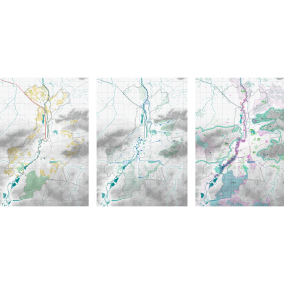
On those four the plan builds a toolbox of Nature-based Solutions — green facades, food forests, restored floodplains — with the service each delivers and the conditions each needs. Then it maps every service across the whole city: where it is needed, where the landscape can deliver it and where it is already at work. Each map is a framework in its own right: the water map, the cooling map, the food map, the biodiversity map.
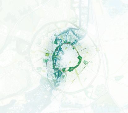
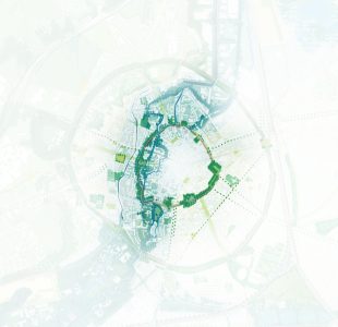
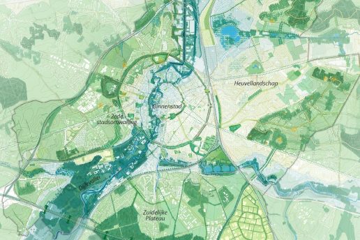
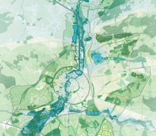
Laid over one another, the maps become one integral green plan. Where services stack, the plan invests. Where one measure delivers several services, it takes priority. The result is a blue-green network that reconnects river valleys, forests, parks, farmland and urban green into one system, with the Dijle valley as its backbone. Read back across the city, that network resolves into four landscape structures, each defined by the services it delivers best.
Four landscapes, one network
The four landscapes, the Historic City Centre, Northern Lowlands, Southern Plateau and Hill Landscape, are the ecosystem service maps made spatial. Each has its own character, and each takes its strategy from the services that concentrate there.

Historic City Centre
The historic city centre is dense and built in stone. Its strategy is cultural and regulating: small parks, urban gardens, green facades and heritage-led planting that cool the streets, hold rainwater and give residents places to sit, meet and play close to home.

Northern Lowlands
The Northern Lowlands are open farmland. Their strategy is provisioning and regulating: sustainable food production, water management and nature restoration that reinforce one another across the fields.

Southern Plateau
The Southern Plateau is a mix of forests, campuses and neighbourhoods. Its strategy is green infrastructure and food forests: a continuous green structure that ties habitats together and buffers the plateau against heat and heavy rain.

Hill Landscape
The Hill Landscape is the rolling ground of the witness hills around the city. Its strategy is supporting and regulating: ecological corridors, soil stabilisation against erosion, cleaner water and the recreational landscape at the city's edge.

The Dijle valley
The Dijle valley runs through all four and links them. Each strategy is set where its services add most, to the landscape itself and to the network as a whole.
Four landscapes, one network
The four landscapes, the Historic City Centre, Northern Lowlands, Southern Plateau and Hill Landscape, are the ecosystem service maps made spatial. Each has its own character, and each takes its strategy from the services that concentrate there.

Historic City Centre
The historic city centre is dense and built in stone. Its strategy is cultural and regulating: small parks, urban gardens, green facades and heritage-led planting that cool the streets, hold rainwater and give residents places to sit, meet and play close to home.

Northern Lowlands
The Northern Lowlands are open farmland. Their strategy is provisioning and regulating: sustainable food production, water management and nature restoration that reinforce one another across the fields.

Southern Plateau
The Southern Plateau is a mix of forests, campuses and neighbourhoods. Its strategy is green infrastructure and food forests: a continuous green structure that ties habitats together and buffers the plateau against heat and heavy rain.

Hill Landscape
The Hill Landscape is the rolling ground of the witness hills around the city. Its strategy is supporting and regulating: ecological corridors, soil stabilisation against erosion, cleaner water and the recreational landscape at the city's edge.

The Dijle valley
The Dijle valley runs through all four and links them. Each strategy is set where its services add most, to the landscape itself and to the network as a whole.
Catalytic projects
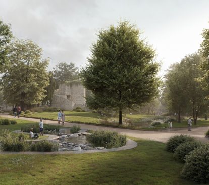
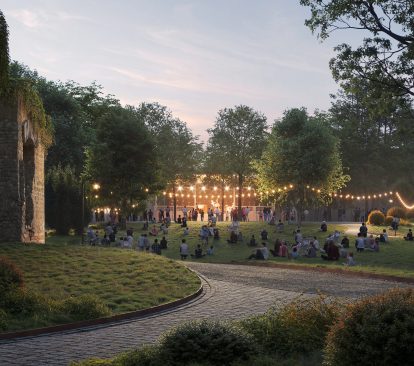
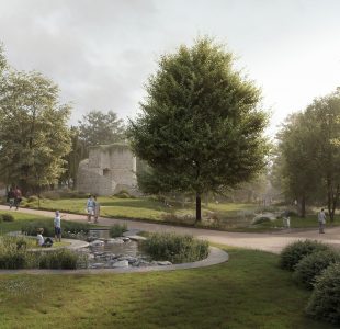
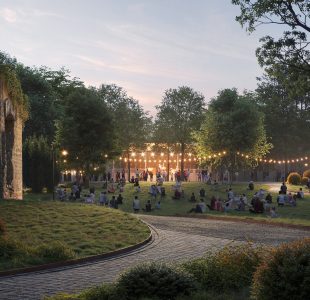
For each landscape the plan names projects that show the network at work. The First City Wall in the centre. The Eastern and Western Hill Parks in the hills. The restoration of the Dijle meander at Wijgmaal in the lowlands. The Akkermozaïek across the farmland. Each activates several ecosystem services at once, and each strengthens the network it sits in. Together they take the plan from strategy to site.
A living plan
The plan was made with the municipality, knowledge institutions, organisations and residents in a broad participatory process. It sets opening conditions rather than a final state, and keeps developing as the city does. It is the spatial basis on which Leuven delivers its commitments under Leuven 2030 and the European Mission for 100 Climate-Neutral and Smart Cities.
Working together
Felixx and Witteveen+Bos developed the Strategic Green Plan for the City of Leuven between 2023 and 2024. The College of Mayor and Aldermen and the City Council approved the plan unanimously in November 2024. More at leuven.be/groenplan.
Want to learn more?

Elan Redekop van der Meulen
Associate partner, landscape architect, researcher"A Green Plan is not a plan for green space; it is a plan through green space. By taking ecosystem services as our starting point, we move beyond sectoral thinking and connect landscape to the city's broader ambitions. In doing so, a robust landscape structure becomes not the outcome of urban development, but its foundation."
Knowledge Hub
Strategic Green Plan Leuven
Felixx, in collaboration with Witteveen+Bos, has developed the Strategic Green Plan for the city of Leuven, Belgium. This plan is a key instrument to make the city greener, healthier, and more climate-resilient in the coming years.
Unanimously approved in November 2024 by both the City Council and the Municipal Executive Board, the Green Plan outlines a clear vision for a sustainable and livable future for all residents.
More info
- team
- Felixx
- Witteveen + Bos
- photography/visuals
- Felixx
- César-François Cassini de Thury
- Vasily Malygin
- awards
- 2026 WLA Awards [shortlisted]
- publications
- Architectenweb
- Architectura
- Architectuur.nl
- Bouw & Wonen gooood
- GWW Bouw Mat HLN
- Landscape First
- Leuven Actueel
- RobTV
- WLA


